


Bill 19
-
Posts
3 -
Joined
-
Last visited
-
Days Won
1
Content Type
Forums
Gallery
Events
Shop
News
Audio Archive
Timeline
Posts posted by Bill 19
-
-
2 hours ago, James said:
Hi Bill
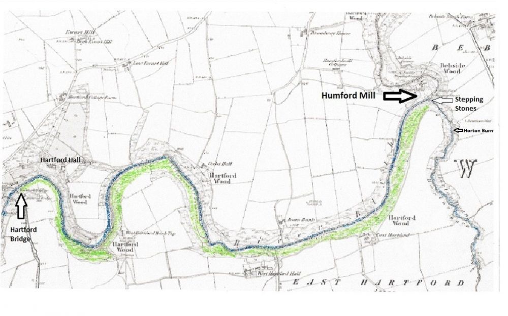
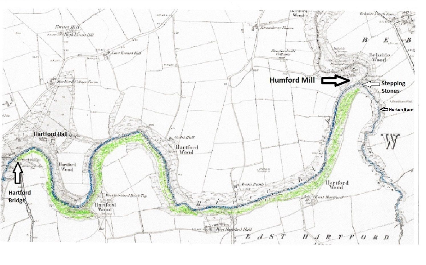
I know the walk you describe in your post (did it last year) but didn’t see the structure you mention. I have attached a plan with the Hartford Woods shown in green. The footpath leads through these woods.
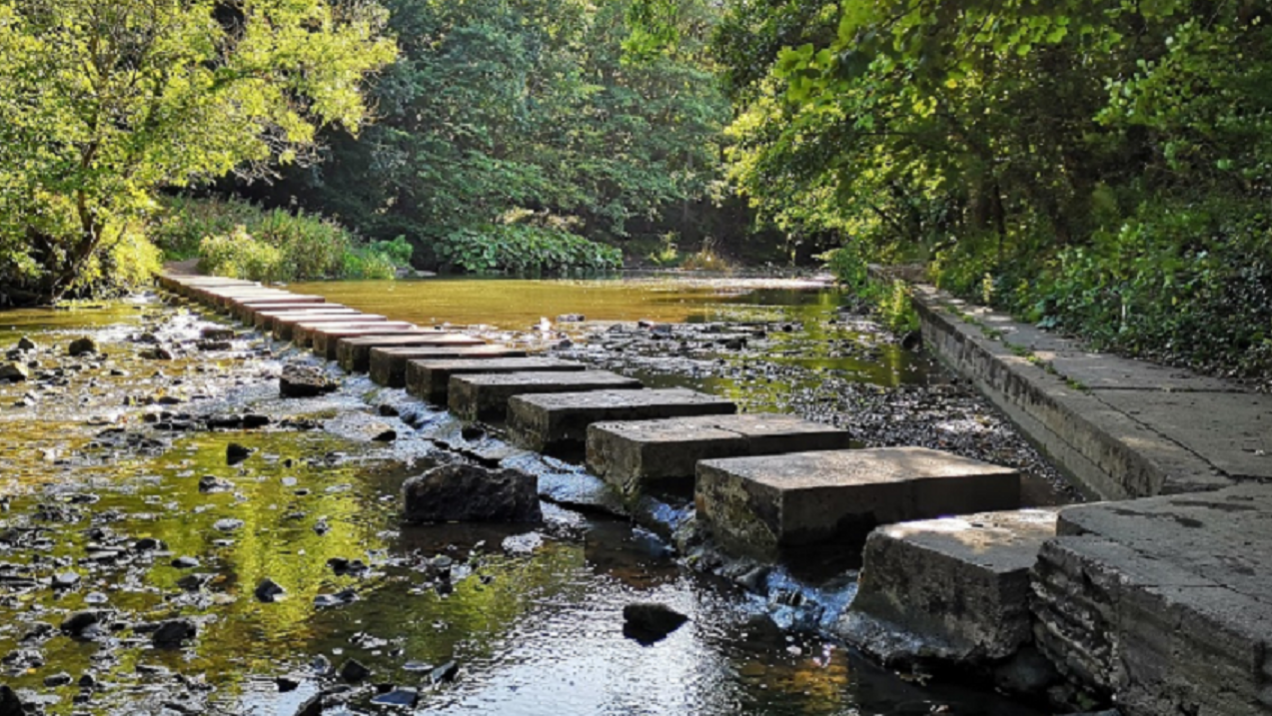
As you say, to get there, you have to walk over the stepping stones at Humford Mill to the Hartford side of the river, turn right over the wooden footbridge that crosses the Horton Burn and into Hartford woods and follow the (difficult) footpath that leads to Hartford Bridge.
Can you give a rough idea of the location of the structure you saw on your walk?
There are two distinctive features on the walk; first the huge concrete culvert that was built to drain water from Brentford Nylons and the other is the dam that used to supply water to the swimming baths. Is it near any of these two points or at the end of the walk, i.e. the field that leads to Hartford Bridge (opposite Hartford Hall)?
Any other pointers would help, e.g. at the top perimeter of the woods along the fields, or near the river.
Another possibility is that when you state at the “top of the bank”, perhaps you followed the footpath through Horton Dene which is a fairly steep walk along the burn towards Hartford Colliery (East Hartford)

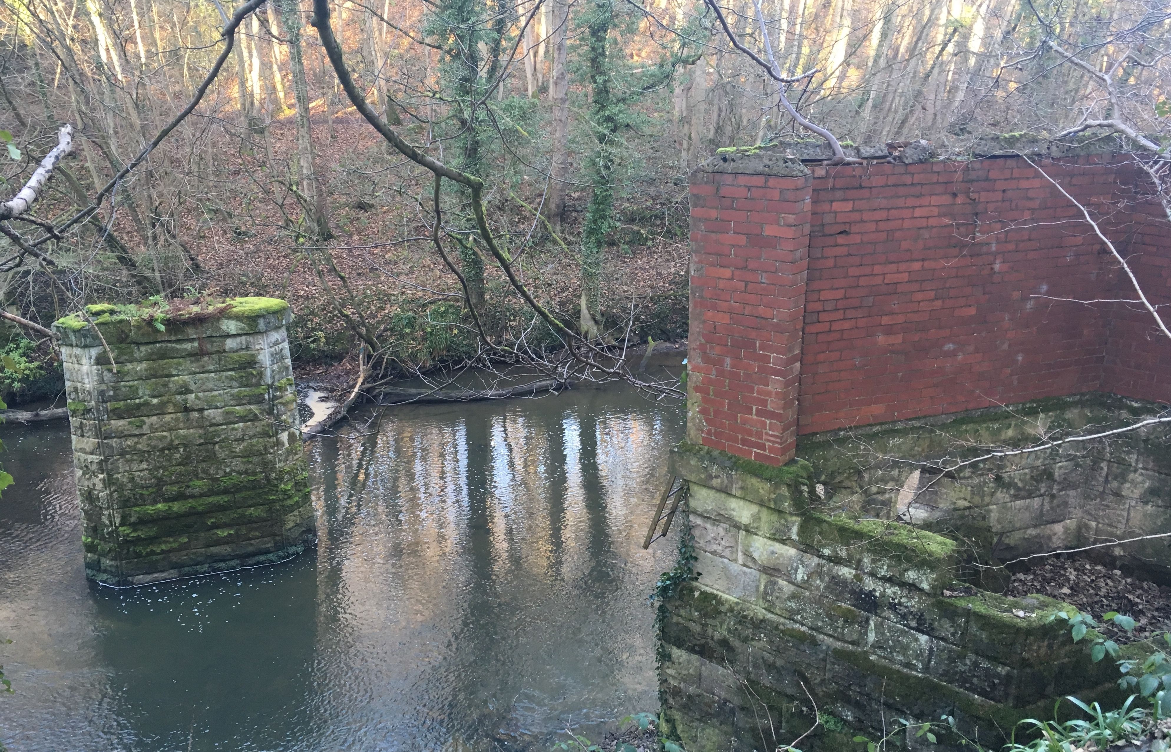
Hi James, thanks for your reply. I can understand how you didn’t see the site, because at some points where the path had disappeared or become blocked, you had to choose between going higher up nearer the fields, or lower down nearer the river. The site was indeed near the top perimeter of the woods near the fields, and it’s only visible when close to it, so would be easily missed if you walked past it lower down, and I’m not even certain I’d go exactly the same way if I tried again, due to the options of taking different routes when the path runs out or becomes boggy, etc! However, there is a narrow path running alongside it for a short stretch, which I guess is used when the site is inspected periodically for security/safety. Difficult to estimate exactly where it was, I’d guess about 2/3 of the distance to Hartford Bridge, I think some time after passing the attached structure (not sure if that’s one of the structures you mention). Maybe I’ll try again in the summer when the path is hopefully not so muddy at some points, and try to get a photo of it!

-
 1
1
-
-
Hi all.
New member - very interesting and informative thread.
Does anyone know the small fenced-off Coal Board site on the south bank of the river between Humford Mill and Plessey Woods? It’s near the top of the bank, and there’s an entrance door and a half-visible fan of a few feet in diameter. Presumably it’s a ventilation fan and its machinery.
Unfortunately I didn’t have a camera on me when I saw it, but it’s just north of the Hartford part of Cramlington, so would it likely be related to the Hartford (or possibly Plessey) mine?
It’s not easily accessible - I came across it while on a walk to see how far the footpath goes on the south bank after the steppingstones at Humford. The path soon becomes blocked by fallen trees, overgrown bushes, etc, and is quite dangerous at a couple of points, with steep muddy drops to the river!
-
1
-
Coal Mining
in History Hollow
Posted
Thanks HPW and James, very interesting.