James
-
Posts
213 -
Joined
-
Last visited
-
Days Won
53
Content Type
Forums
Gallery
Events
Shop
News
Audio Archive
Timeline
Everything posted by James
-
Hi John The 6 townships website is no exists. This sounds like a great DVD and I was wondering if it is still available. It would be greatly appreciated if If anyone knows how to obtain this video
-
Were any of your wife's relatives on the Roll of Honour?
.png.6771405b903bbe716d682dc88b309dc5.png)
-
Canny Lass You are getting mixed up with the two different Mechanics Institutes. Evan Matin's book is about the Ironworks Mechanics Institute. The 38th anniversary refers to the Colliery Mechanics Institute.
-
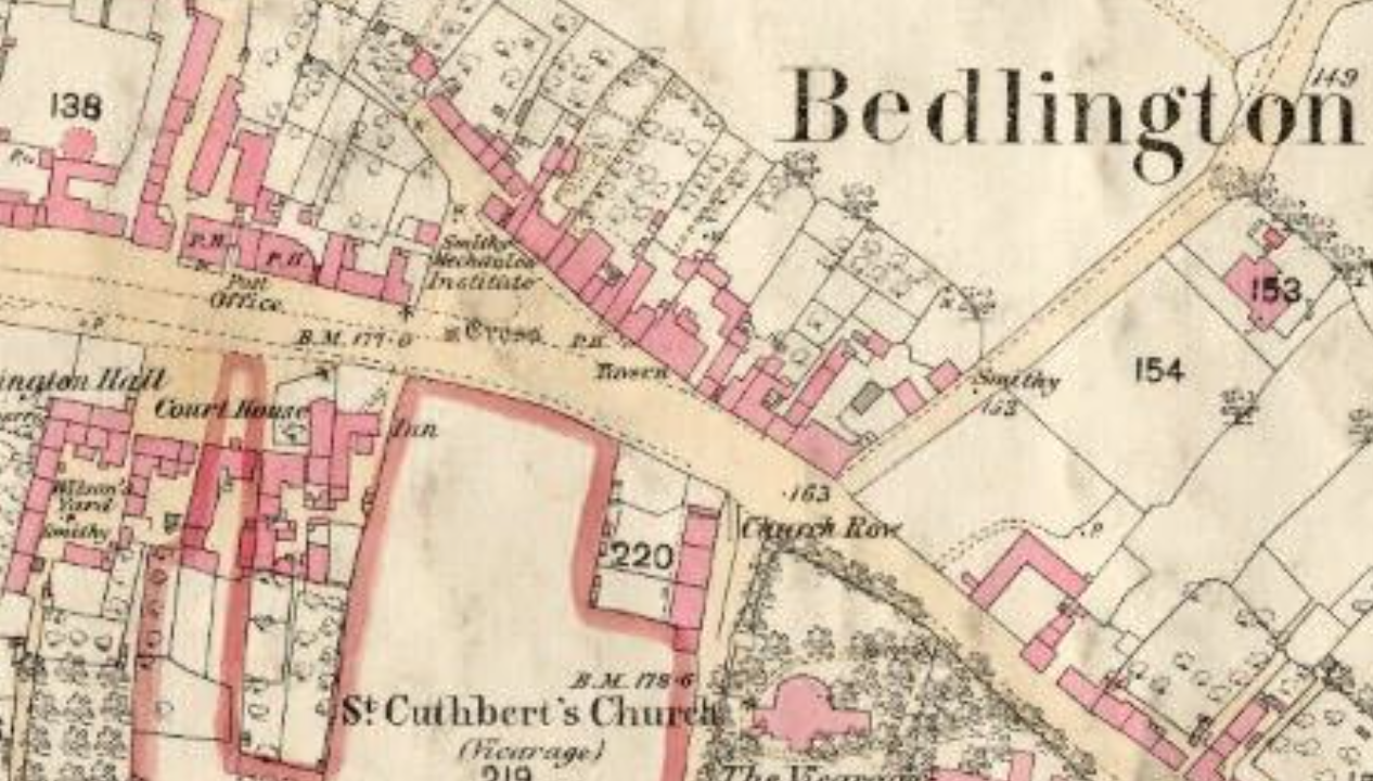
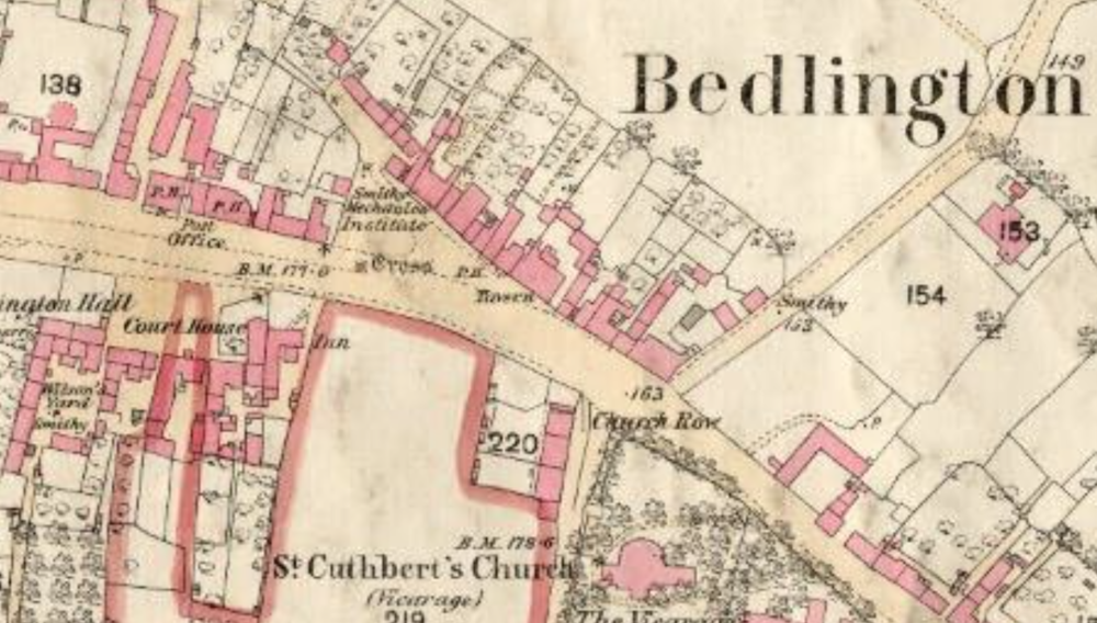
Canny Lass The Bedlington Iron and Engine works operated between 1736 and 1867 and The Doctor Pit operated between 1855 and 1968. Each had their own Mechanics Institute. The Ironworks Mechanics Institute was in the Clock House at Furnace Bank and was opened in 1829 (from Evan Martin’s book on the Ironworks.) The Colliery Mechanics Institute was initially at the Market Place and then moved to what is now the community centre. I don’t know when it opened but it is shown on the 1860 map of Bedlington so it must have been shortly after the colliery started operating
-
Eggy It was never known as the Top End Mechanics Institute. It was the Colliery Mechanics Institute, referred to by everyone as “The Chute.” Your map shows its location after it moved from the Market Place. The 1860 map I have attached shows it when it was in the Market Place. We were told that it was situated in the building that later became Peter Bacci’s shop (there was a billiard room at the back of his shop with two billiard tables.) but I have no proof of this although the map indicates that this is where it was sited. You have posted an 1896 map and mine is dated 1860 so it must have moved between those dates.
-
Symptoms The full name of the institute was the Bedlington Colliery Mechanics Institute. It was first located in the Market Place (Peter Bacci’s shop) then moved to what is now the community centre. This was the only colliery institute in Bedlington. The other colliery institutes were at Netherton Colliery, Bedlington station, and Barrington (the Glove Factory)
-
I believe it is at the Beamish museum.
-
The photo is from Evan Martin's book 'Bedlingtonshire Now and Then'
-
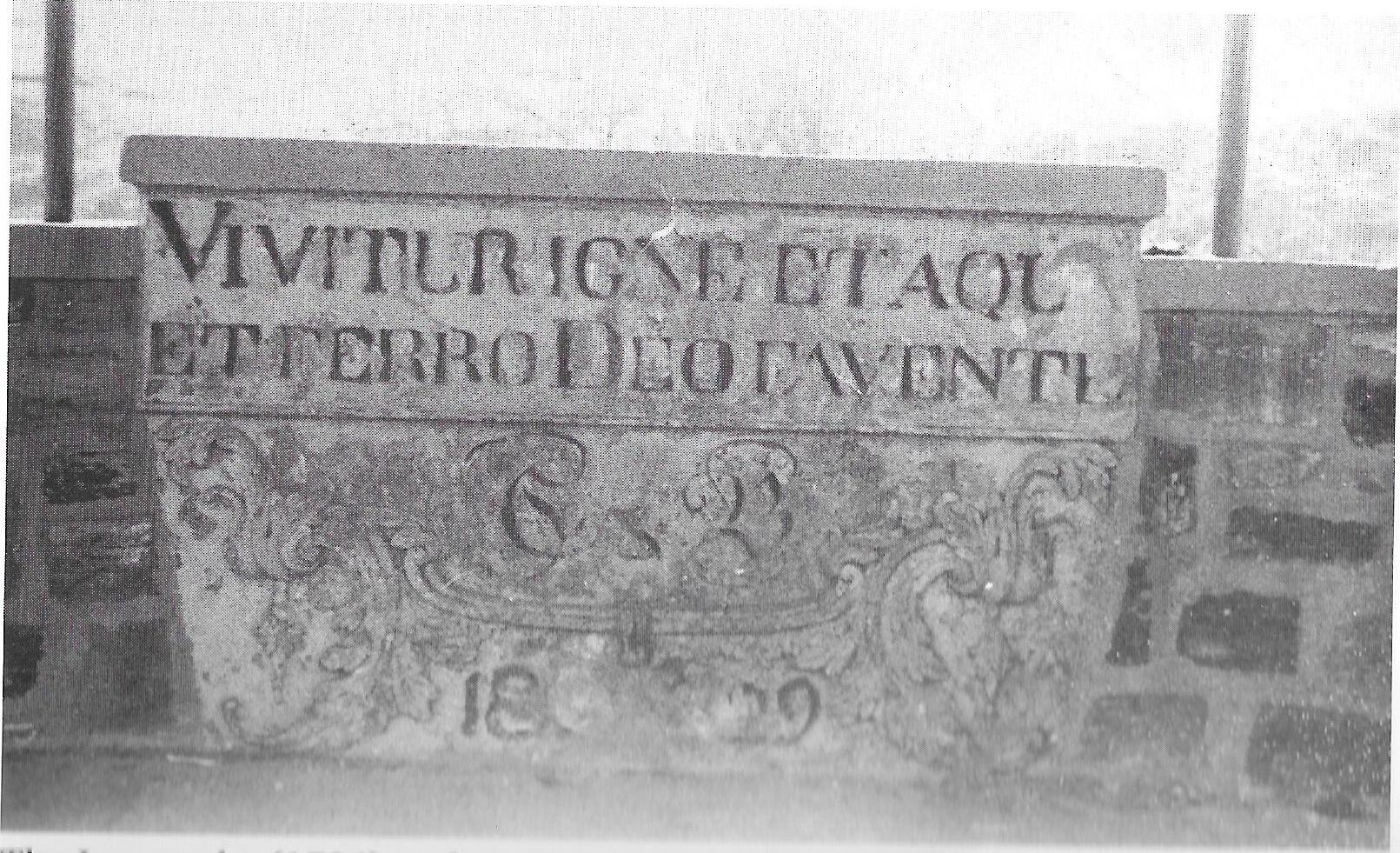
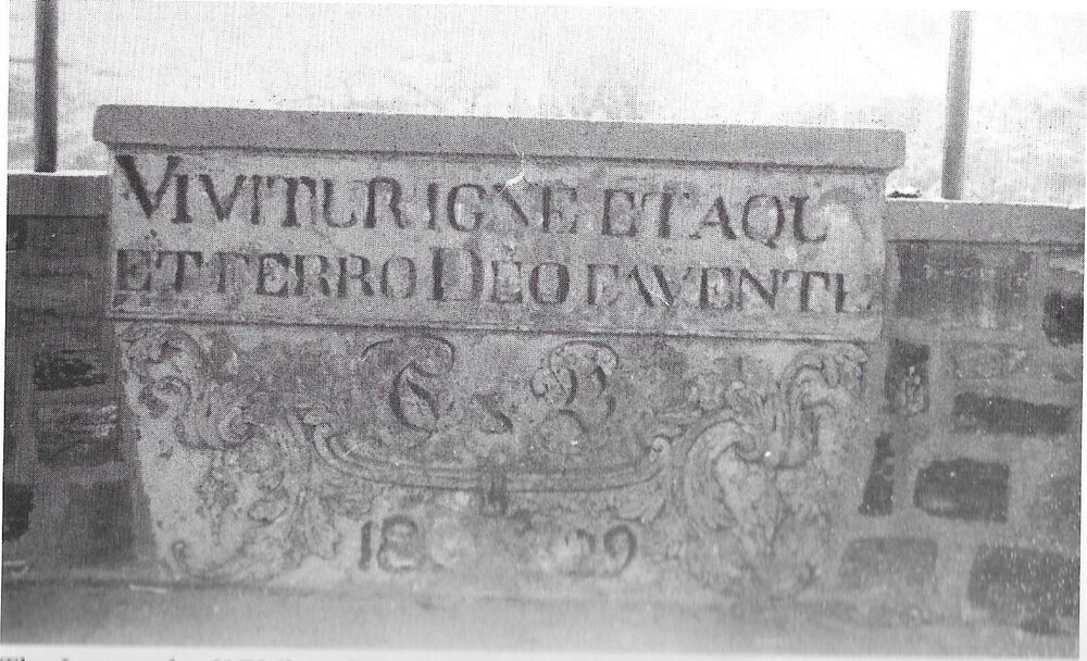
Evan Martin, in his book on the Ironworks states the bandstand was built in 1959 when the buildings around furnace bank were demolished, the site cleared and Dene Park formed. The stone from the institute engraved with the works motto ‘Vivitur Igne et Aqua et Ferro Deo Favente (‘We Live by Fire, Water, Iron and the Grace of God’) was set into the newly built bandstand and this can be seen in the photo. The bandstand was demolished in the 1970’s. At around the same time a bandstand was built near Spring View at the bottom end of Bedlington. The Salvation Army band and local Colliery bands used to give concerts at these two bandstands and they were quite popular for a while then along came TV and people lost interest in that sort of entertainment.
-
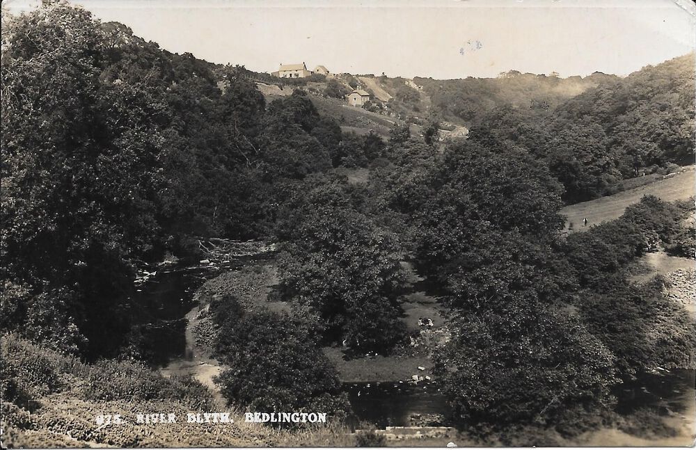
The photos show the area you refer to. The river at this point was tidal so it was a bit deeper at high tide. You had to keep clear of a raw sewage outfall on the Bedlington side of the river!

-
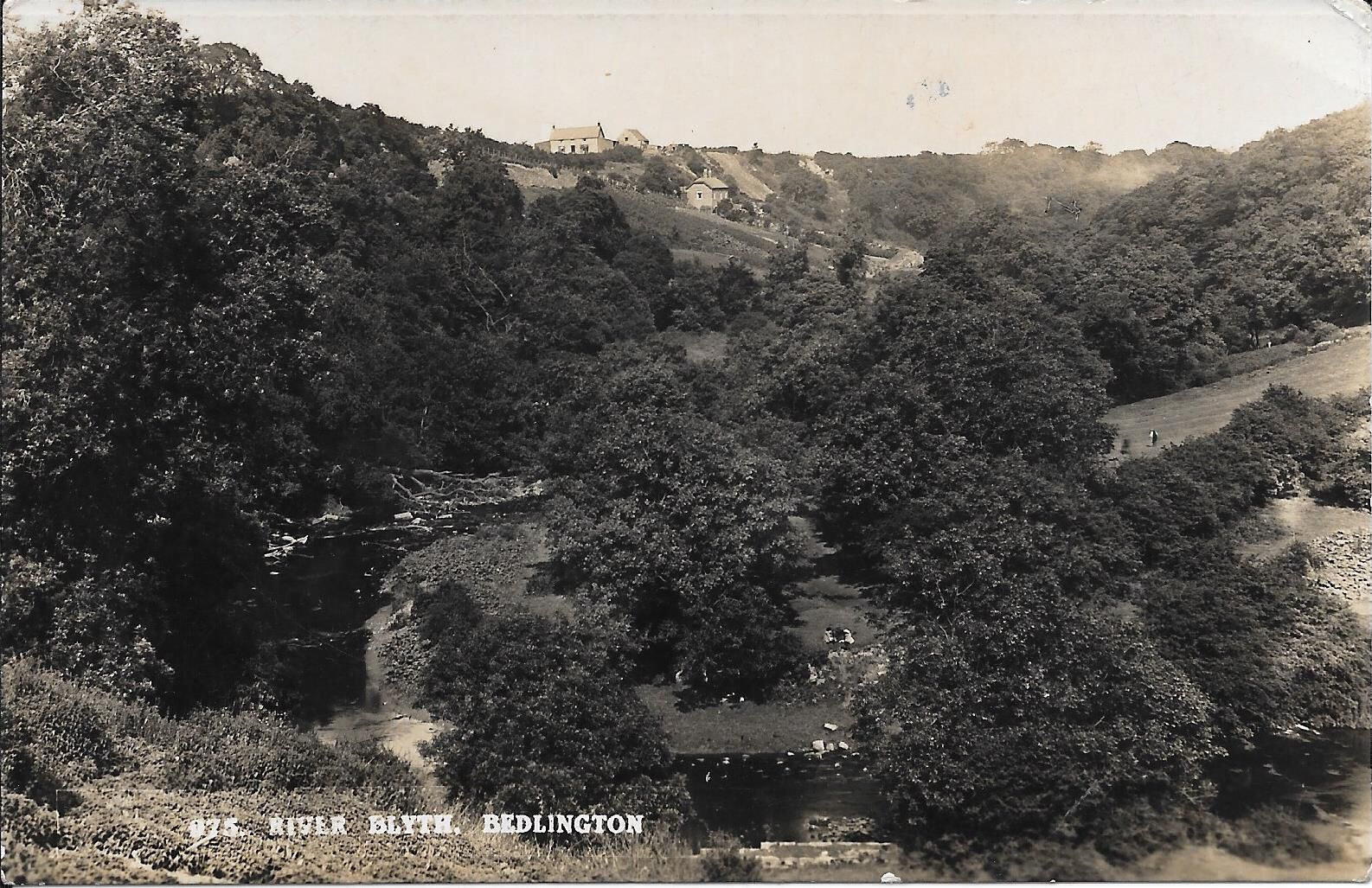
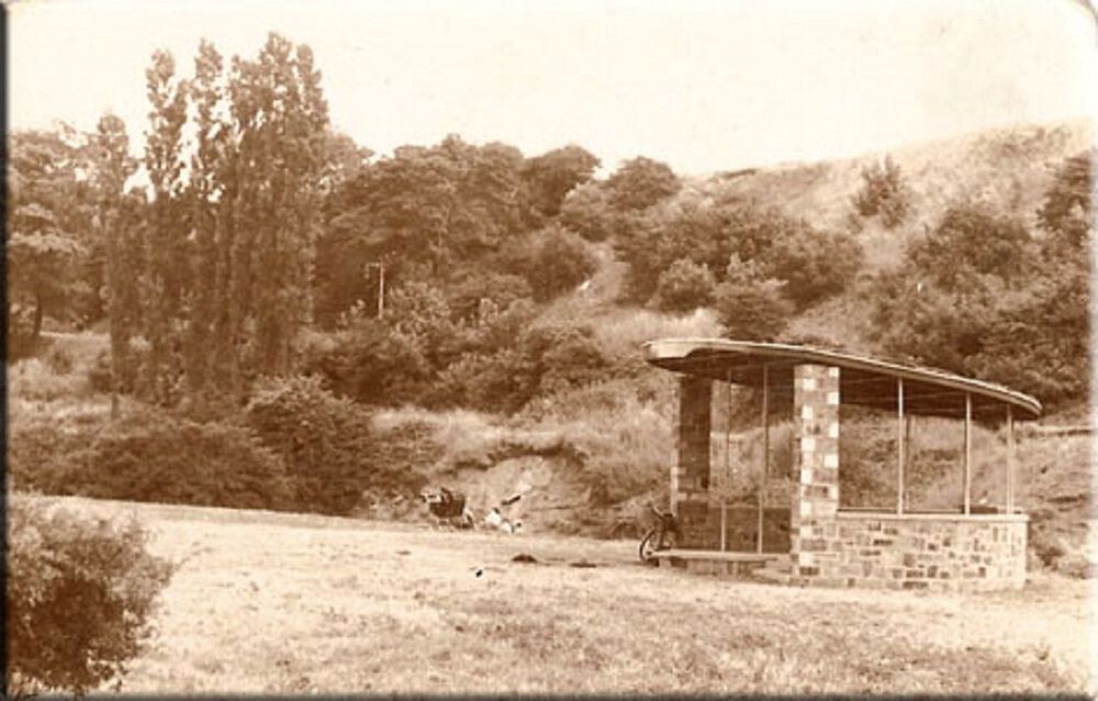
In the 1950's, below Beatty Road there was a bathing area in the river called “The Flaggies” where the river was deepened by damming the water with rocks. The clearing in the woods where everyone would gather was on the Ha’penny Woods side of the river and in the summer during school holidays and weekends a fire would usually be lit and kids would hang around all day until occasionally someone’s mother would call out across the river telling us it was getting late and time to go home. There was a similar bathing area half way along the Piper Woods called the ‘Big Bather’ and this was mainly used by kids from Millfield and the bottom end of Bedlington. The Piper Woods are the woods between Bedlington Bridge and Humford on the Blyth side of the river that are no longer open to the public.
-
Heather’s photos are great – is it possible she could have them properly scanned? I cannot work out where the last 2 were taken. I can remember two cottages down the black path and walking from Beatty Road down to the furnace bank, the first one was on the right hand side of the road and the second on the left hand side. Probably the first of these cottages is the one in the photo that was taken from Bedlington bank with the Ha’Penny woods on the right. The photo was taken before Beatty Road was built and the farm house at the top is Mill Bank.
-
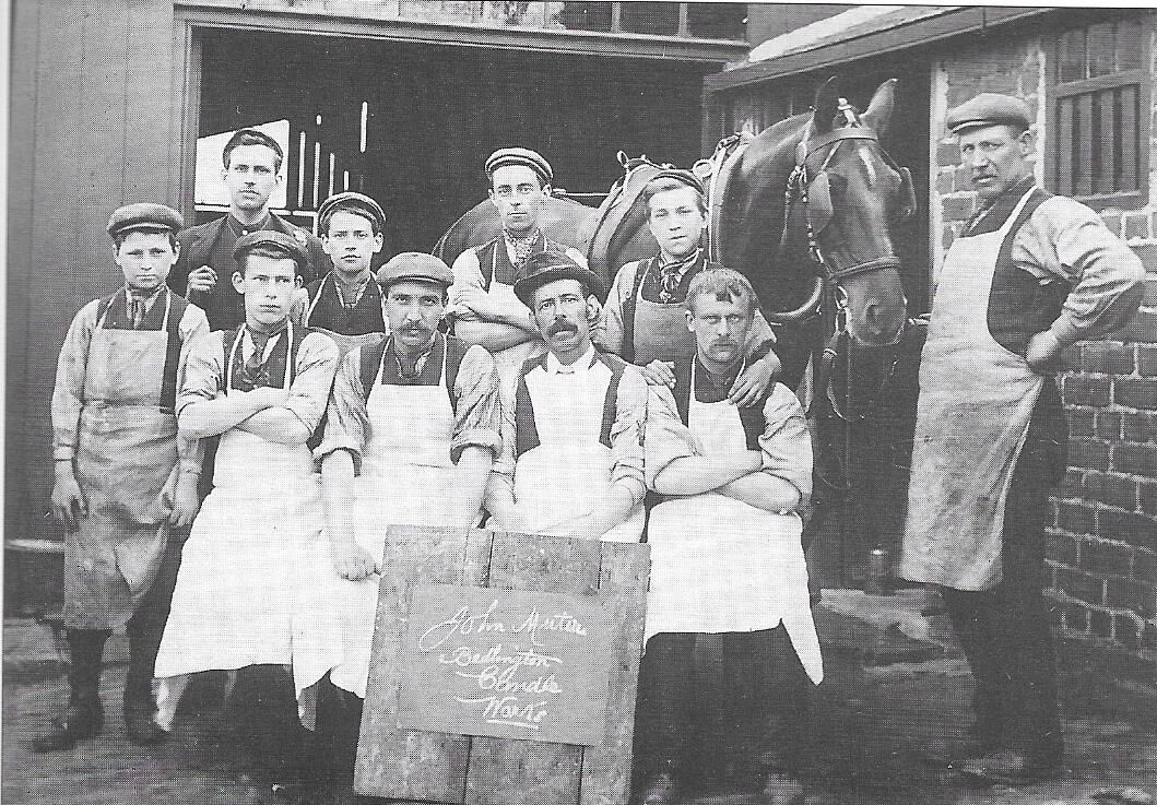
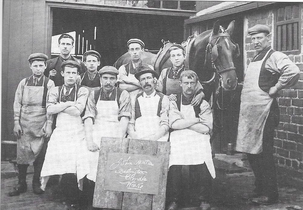
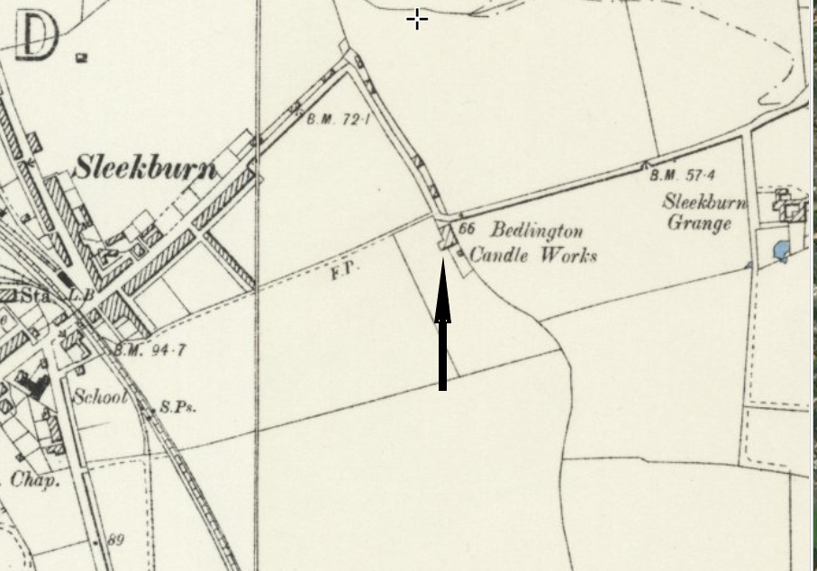
The other candle factory was Muter’s candle works and was situated at the bottom of St Johns Road where it meets the Stakeford Road. (Cross roads with traffic lights.) Across the road is Moorland Avenue on the way to Cambois. The photo is from another one of Evan Martin’s books.
-
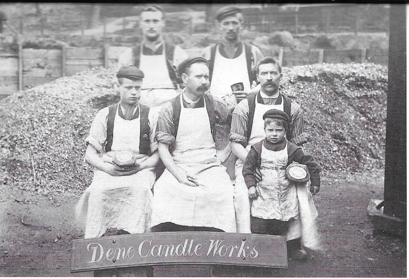
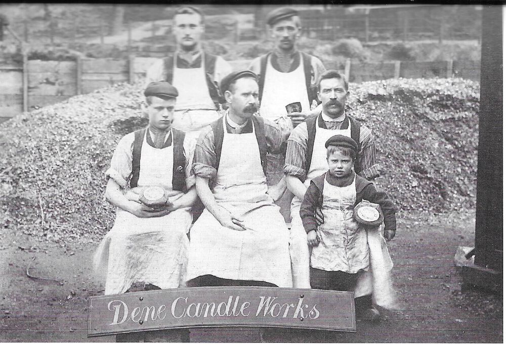
The 1901 census shows that Thomas Bestford lived at the Ironworks and was a candle maker so he must have worked at the Dene Candle Works, at the bottom of furnace bank. The photo, taken 1908 is from one of Evan Martin’s books.
-
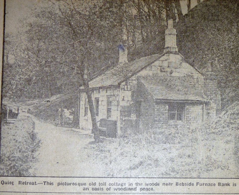
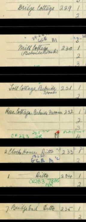
It is recorded as Toll Cottage in the 1939 census and called toll cottage in the newspaper cutting.

-
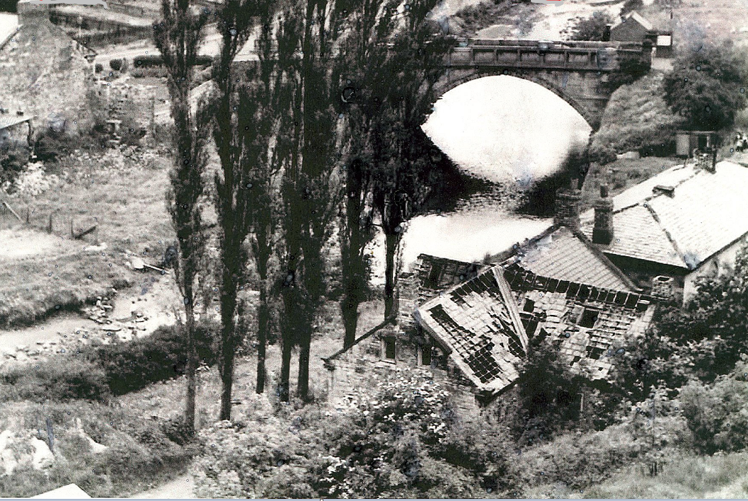
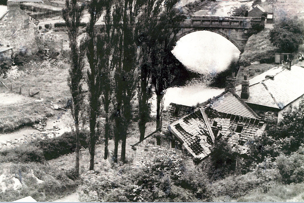
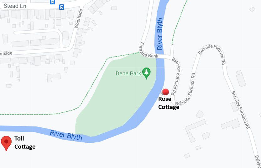
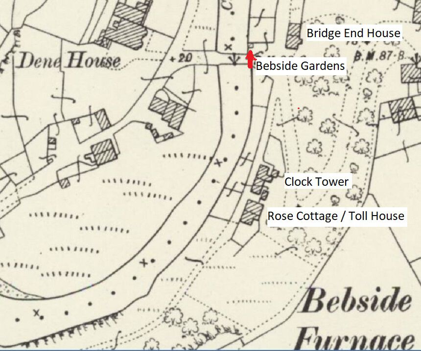
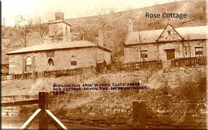
Canny Lass After seeing your message I searched a bit more to confirm my view that Rose Cottage and the Toll House was the same building and have to admit I was wrong! Toll Cottage was about 300 yards from Rose Cottage. I looked at the 1939 census and it records the residents in Bebside wood (i.e. the Ha’penny wood); starting at Bedlington Bridge following the river through the woods down to Furnace Bridge. It starts with Bridge Cottage, followed by Mill Cottage, Toll Cottage, Rose Cottage and Clock House. Bridge Cottage is the only building still there today. It is the house on the bend after crossing Bedlington Bridge on the way to Blyth. If you want to see the relevant page of the census search for Adam Gray, born 1 May 1908. Lived in: Toll Cottage, Bebside Woods, Blyth. To prove that I was completely wrong with my assumption, I came across the attached photo showing Rose Cottage in such a dilapidated state that it was beyond repair. All the buildings in the census can be seen in the old map in the link show below. Toll Cottage is about 300 yards from the furnace bank entrance into Ha’penny woods. I am not sure about copyright laws regarding the posting of information from Old Maps and the 1939 census. Anyone know if it is allowed? https://maps.nls.uk/view/132267629
-
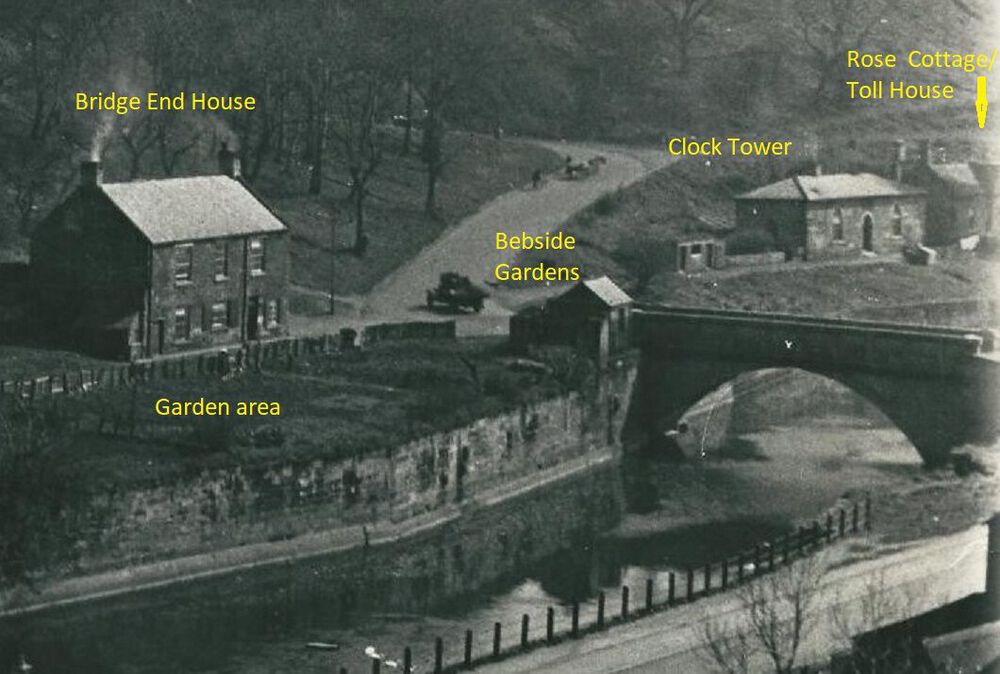
Canny Lass. Your comments have got me interested enough to investigate the toll house a bit further. In the 1950’s I walked through the Ha’Penny woods a number of times so I must of passed the Toll House but I cannot remember ever seeing it. In the 1901 census, there are on 4 properties around furnace bridge on the Cowpen side of the river, recorded in the following sequence- Bridge End House with 4 families; Bebside Gardens with only 1 resident; Clock Tower with 2 families; Rose Cottage with 1 family. These 4 properties are shown in old maps from this period. The toll house has to be one of these buildings and it can only be Rose Cottage. Comparing the old photo of Rose Cottage with the toll house in the newspaper cutting , the windows, chimneys and gable ends are the same, the only difference being the fancy roof above the entrance door which could easily have been modified. The location is exactly where the toll house was situated - at the entrance to the woods on the footpath and there were no other building where a toll could have been as can be seen on the old map. Bebside gardens is the only house that is unclear but I believe it was the building that Joe asked about that started off this topic i.e the building next to the bridge opposite Bridge End house. The single occupant of Bebside Gardens in the 1901 census was a ‘gardener’ and next to the building is a huge garden. A gardener living in Bebside Gardens alongside a large garden!

-
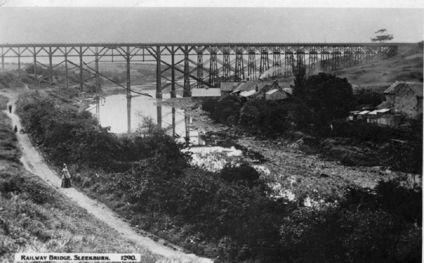
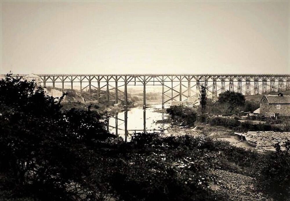
Two earlier photos of the Rose & Crown showing the wooden bridge. The Bedlington Coal Company built the first Bedlington Viaduct in June 1850 as part of its line from Newsham to Bedlington. It was a timber trestle bridge designed by Robert Nicholson, 80 feet high and 770 feet long. (From article “Bridges on the Blyth”) In 1930 the old wooden structure was demolished by the London and North Eastern Railway and was replaced by the present iron bridge (The Black Bridge). (From article “Bridges on the Blyth”)

-
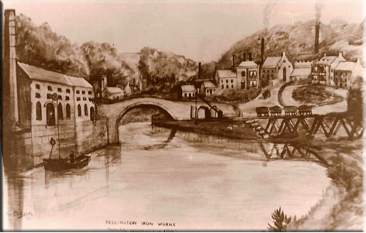
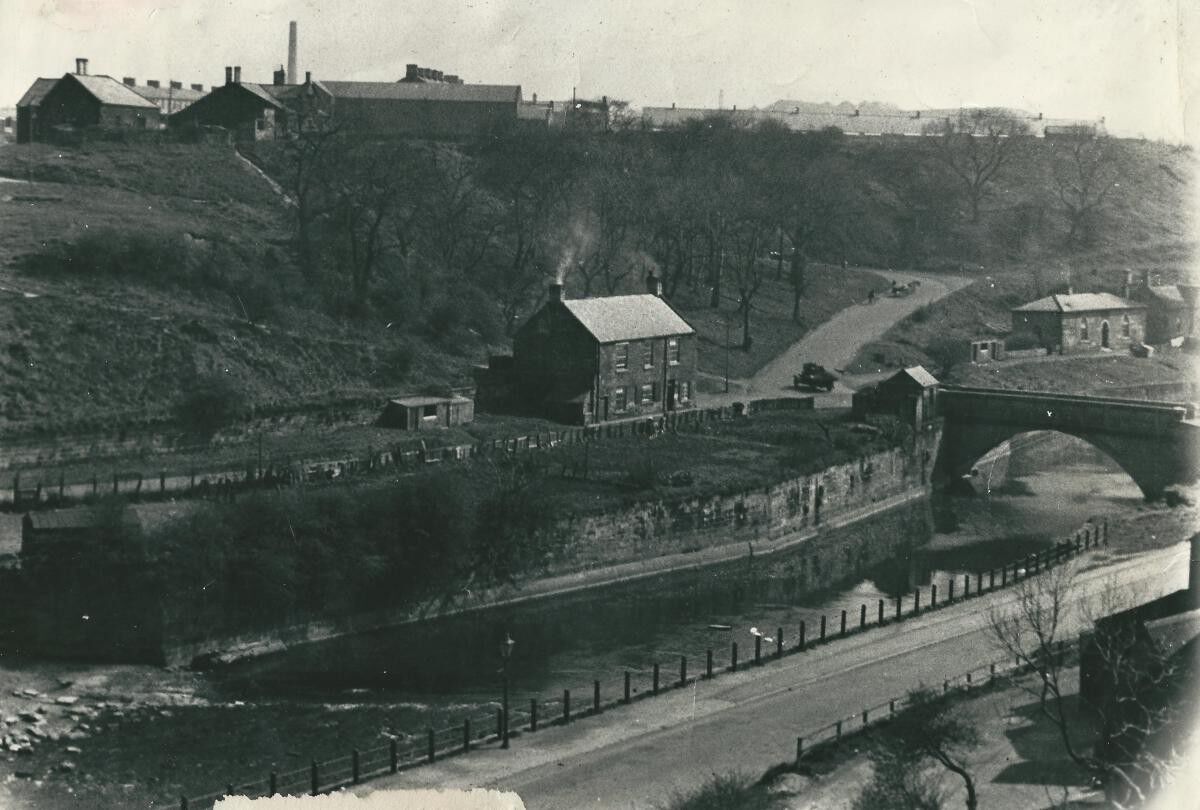
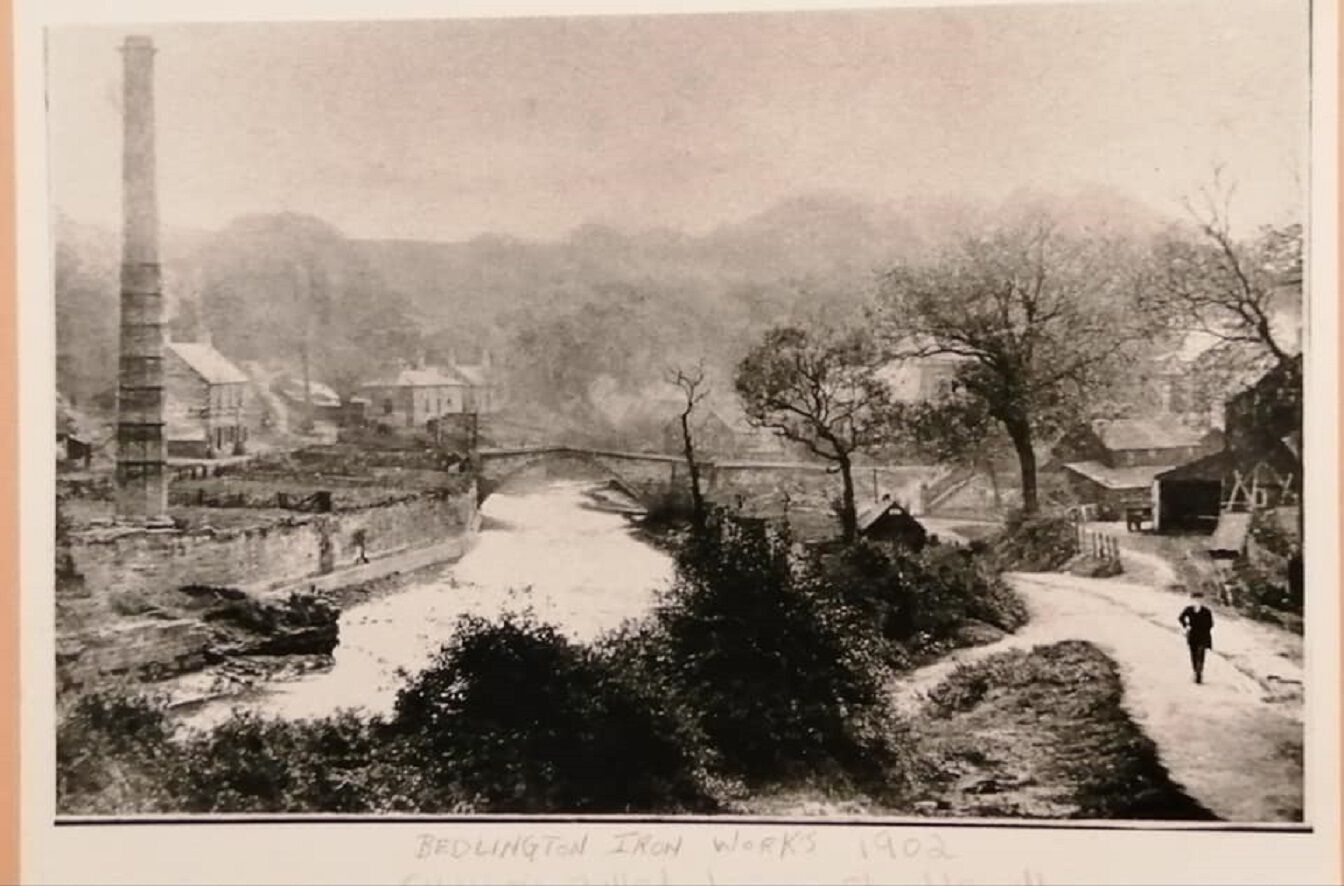
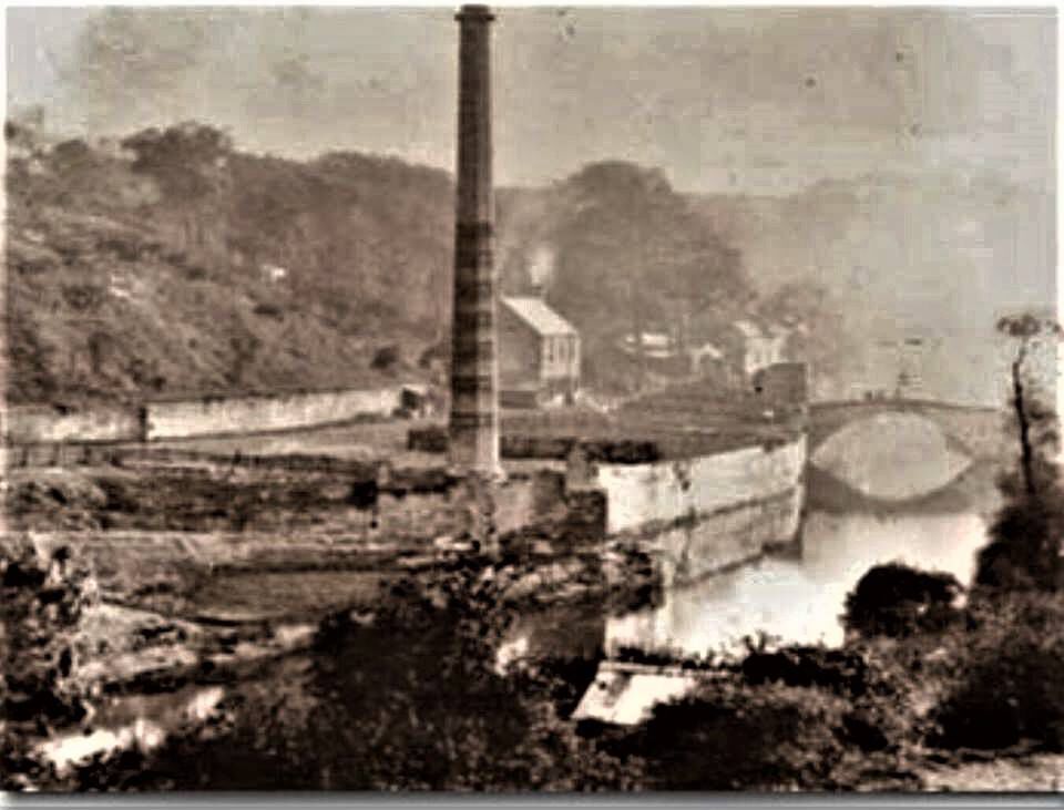
The sketch and 2 photos are all looking upstream towards the furnace bridge. The sketch by C Bergen (presumably Christopher Bergen who wrote the article about the ironworks) shows the chimney and attached buildings are built on the quay, and the 1902 photo shows they have been almost completely demolished, except the chimney. However it does look like there a small building remaining next to the bridge that could be the small building mentioned by Joe. The sketch shows a ship being unloaded or loaded so the buildings must have been warehouses for storage of goods that have been unloaded or are for loading onto ships berthed at the quay. Even today you can see the steel mooring rings anchored into the side of the quay.

-
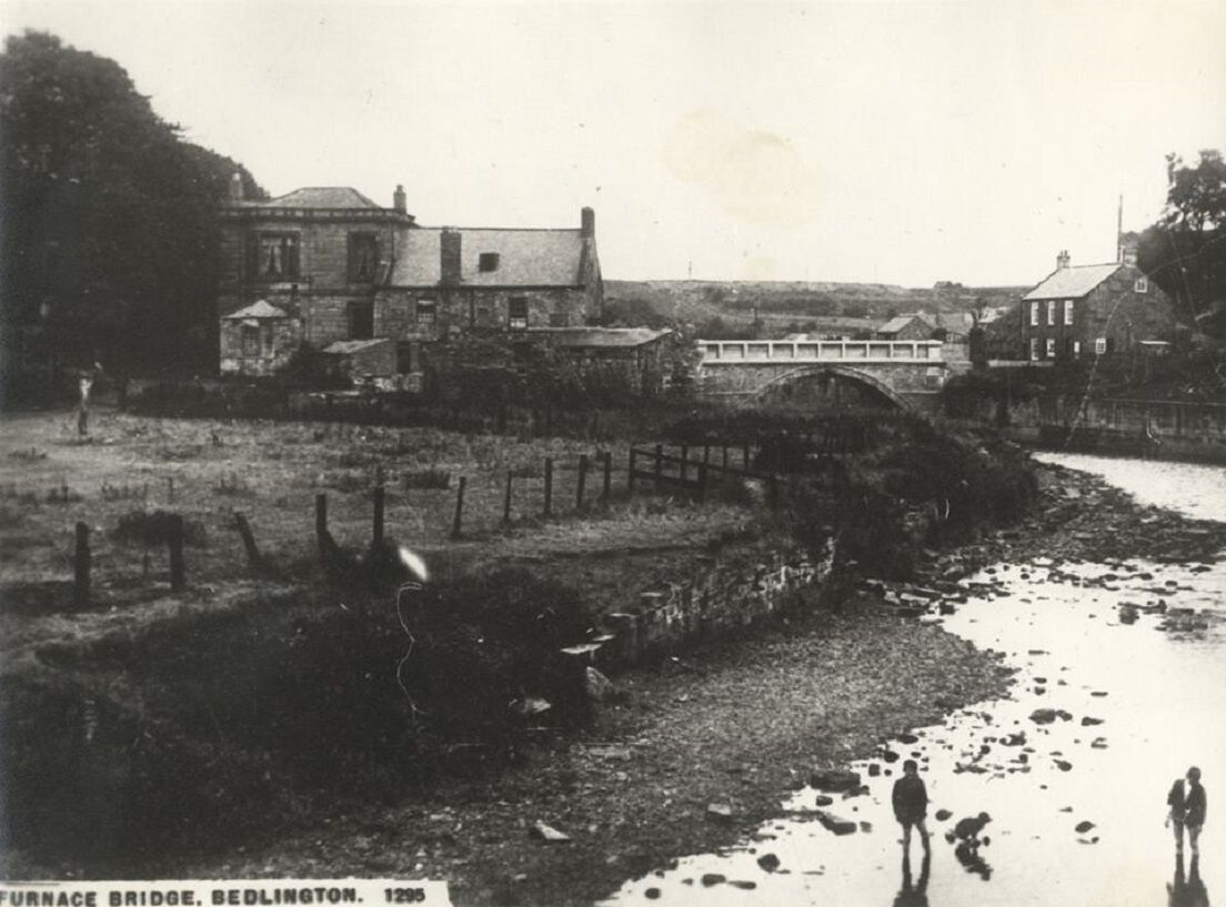
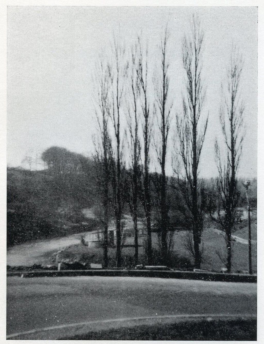
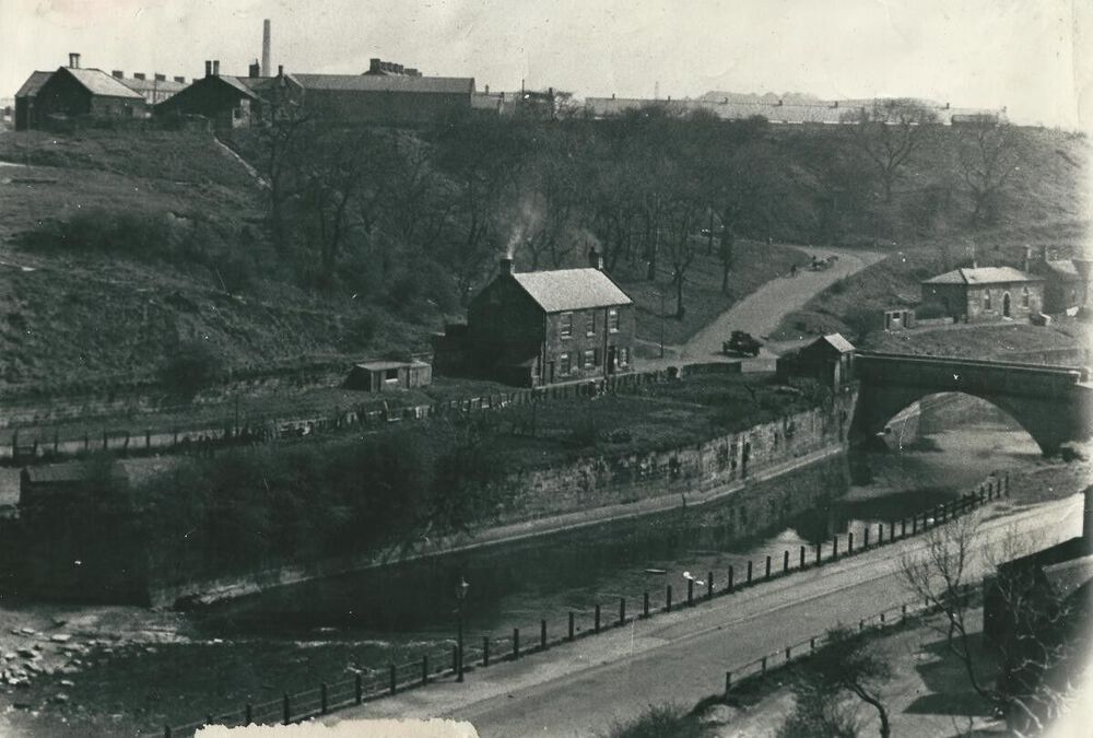
In Evan Martin’s book ‘Bedlington Iron and Engine Works’, he states that in 1829 a workmen’s institute was built where books and newspapers could be read and courses were run for the employees. He goes on to say that inscribed on a stone in the institute was the company’s motto ‘Vivitur Igne et Aqua er Ferro Deo Favente’ (We live by fire, water, iron and the grace of God) Although he doesn’t say that this was the clock house, after reading the document written by Christopher Bergen posted by Canny Lass, it must have been. Bergen’s document says the Clock House had a stone above the door with the same motto mentioned by Evan Martin with the date 1829. He also states the Annual Meetings of the Relief Fund was held here followed by a dinner provided by management. It would appear that the clock house was the workmen’s institute converted to housing after the works closed. I have attached an old photo of the bandstand taken from the hairpin bend behind the 7 poplars we used to call the ‘Seven Sisters’.

-
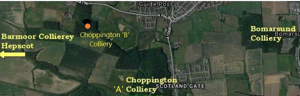
Hi Eggy, I have added the exact location of Choppington ‘B’ to your map.
-
To make sure I don't upset (HPW), there were two Choppington collieries - Choppington 'A' (the low pit) and the pit where HPW worked, Choppington 'B' (the high pit)
-
In the 1939 census Jane Isabella Smail was living in the shop with her daughters Isabella and Catherine.