loopylou
New Members
-
Joined
-
Last visited
Everything posted by loopylou
-
I have a booklet about the Welwyn somewhere (which has photos) but will need to have a rummage about to find it.
-
 Thanks 😊 they work quick on there!
 -
 Thank you 🙂
 -
@Alan Edgar (Eggy1948) that would be lovely, thank you. I should be able to give a list of names soon. I’ve also got another picture from 1920 to reupload (although its a question of if they can be named from that long ago 😆)
-
@Canny lass thank you very much, that must’ve took a while to do (and write)! I tried using the pub method before but certainly wasn’t as effective. Now it seems quite obvious- the west row would be west and the east row would be east… 😆
-
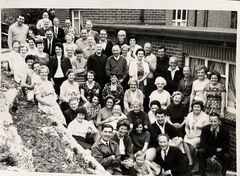
Early 1950s I think
-
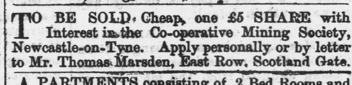
A potential lead on from a newspaper article in 1874, I’m thinking maybe this East Row in 1871 was at Scotland Gate. Unless there were two, one there and one in Guide Post. 🤔 I’ve just checked and Thomas Marsden does appear in the 1871 census a few pages from my ancestors. So Scotland Gate, not Guide Post.

-
@DJA 24 Thank you for your reply. I’m already aware of the NLS maps (and what a brilliant resource they are!). I’ve looked at the Guide Post maps but unfortunately as you say, they don’t bring up much even when the layouts have been the same. Guide Post is quite a mystery… I searched up one of the named streets, Blyth Terrace, and even that has been enigmatic in results except a few newspaper articles.
-
@Canny lass Must be one of those days for me, full of typos. It is 1892, just had a double check.
-
Hi, I’ve been looking on the census at where my ancestors (Storey) lived in 1871 and 1881 and came across two places I’ve never heard of; East Row (1871) & Choppington Row (1881). Both in Guide Post. Does anyone know anything about them? Thank you.
-
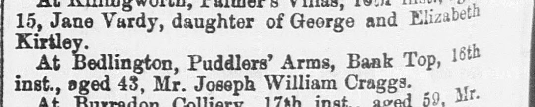
@Colin Nichol How sad. I should correct that William was buried 25 Oct 1914, not January. Don’t know where I got that month from! Found his obituary in Newcastle Evening Chronicle, 24 Oct 1914, page 2. NICHOL - At Wansbeck Cottage, Stakeford, 23inst, aged 5 years and 19 months, William, the beloved son of James and Alice Nichol. Interment at Cambois Churchyard on Sunday at 3.30pm. Friends please accept this, the only intimation. Morpeth Herald, March 5 1898 page 8: At West Sleekburn on 28th ult., Ann Margaret, daughter of Mr. James Nichol. Morpeth Herald, 23 January 1893, page 8: At Stakeford, 16th inst., aged 7 months, Annie Margaret, daughter of Mr. James Nichol.
-
Hi, I had a look through the Cambois burials on FreeREG and was wondering if James and Mary Alice might’ve sadly lost another child? Their youngest William doesn’t appear in the 1921 census with them, but there is this burial. William Nichol buried 25 January 1914, aged 5, residence Wansbeck Terrace Sleekburn. Lou
-
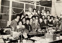
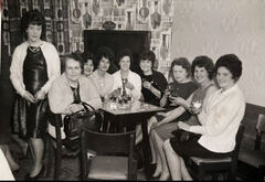
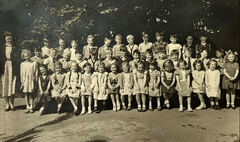
A photo that shares some of those names
-
-
 Thanks for the update @Alan Edgar (Eggy1948) 🙂
 -
I don’t know if you still need this info @Canny lass but thought it may be useful in the genealogy regards. I briefly remember him myself but I was very little (4-5?) when I visited in the Hartlands. His first name was George and he was the son of Christopher (Kit) McGregor and Elizabeth (Lizzie) Tweddle. Lizzie was the daughter of George & Grace Tweddle. Both Kit and Lizzie lived at 9 Cragg’s Buildings in 1921–Kit being a boarder. Geordie was born on 18 July 1923 at Craigs Buildings. His parents at the time lived at Liddle’s Yard. By 1939 him and his parents lived at Yard Row. They then moved to the Hartlands. His grandmother Grace died at 101 Hartlands in 1957. Geordie died in Sep 2008, there is a headstone in Netherton Lane Cemetery. I’m not sure about Kit and Lizzie, though. His uncle (George Tweddle) has a headstone at Netherton and is buried with Grace Tweddle.
-
*50-60s, sorry.
-
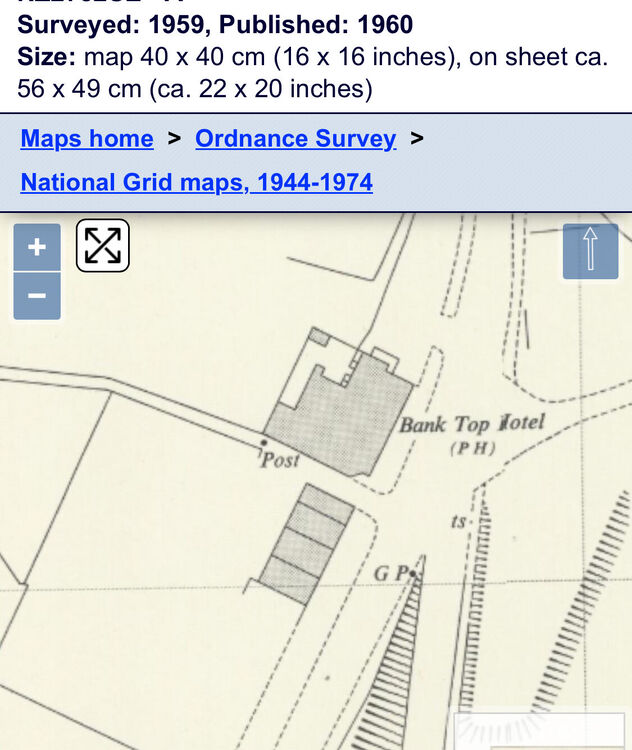
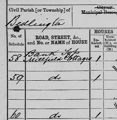
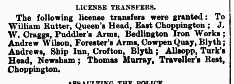
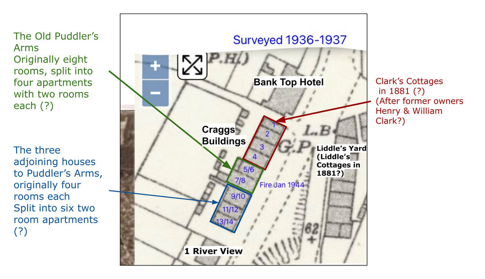
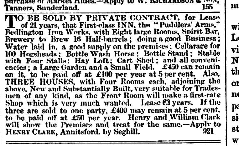
@Canny lass I wonder if there was one family/household per room at that time, hence the ability to squeeze nine families in there. Agreed about Millfield Cottages, there’s no glaringly obvious of the name connecting to the buildings (Craggs & Clark’s being previous landlords), and certainly could be that they were properties further down Puddlers Road. The Brewers Cottage is quite interesting, there was mention of Henry Clark owning/managing a brewery at Bedlington Iron Works, so they could be connected. I’m starting my way through the Puddler’s Raa thread, what an interesting read 😁 Directly from a family member of mine (whose siblings were born in Craggs recalls going to an aunts house in the 1950s, says the cottage (most likely #3) was nearer to the Bank Top Hotel and remembers that it had two rooms. Thinks the remaining properties were demolished in the 50s too.
-
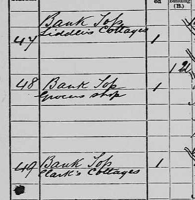
Great work @Canny lass 😄 I agree that this is likely what the buildings were laid out as. A good thing that the enumerator was so detailed. Still such a mystery! A quick peek on the 1881 census brings up also detailed addresses of the area. After Liddle’s Cottages (Liddle’s Yard?) there is “Clark’s Cottages” followed by the Puddlers Arms, then “Millfield Cottages”. After “Millfield” follows Puddlers’ Row. I was wondering due to these two addresses surrounding the Puddlers’, the “Clark’s Cottages” may be a reference to BLUE in Craig’s Buildings, and then “Millfield Cottages” refer to the RED part of Craigs. These addresses aren’t brought up again.
-
It is certainly a mystery @Alan Edgar (Eggy1948)! Thank you for the info it is very helpful. Will have a look at those. I knew about Puddlers Row but was not aware that Glassey Terrace was formerly a Puddlers-related name too. 😄 One thing that confuses me is the way that Cragg’s Bdgs is labelled in the 1911 census. It makes it look like the Puddlers Arms is in the middle of the block and was later renamed to be part of Craggs. Rather than the Puddlers Arms being demolished and replaced with Bank Top Hotel. After Bank Top Hotel the addresses go as; No. 1 Craggs (missing, a shop? Uninhabited?) No. 2 Craggs Buildings (Weightman) No. 3 Craggs Buildings (Elliott) No. 4 Craggs Buildings (Kinghorn) following these are Old Puddlers Arms (Mawson) Old Puddlers Arms (Thain) Old Puddlers Arms (Cole) Old Puddlers Arms (Burrell) All of these addresses ”Old Puddlers Arms” have two rooms each, which equates with the eight rooms described in the auction. then confusingly Craggs Buildings (no number) (McMullen) No. 2 Craggs Buildings (Thompson) No. 3 Craggs Buildings (Hutchinson) No. 4 Craggs Buildings (Campbell) No. 5 Craggs Buildings (Hadaway) Craggs Buildings (no number) (Parker) These also had two rooms each. Then after follows River View. It would appear that No. 2/3/4 are duplicated, but I do not think that these are the same properties, rather that the end six properties later become No. 9-14 of Craggs.
-
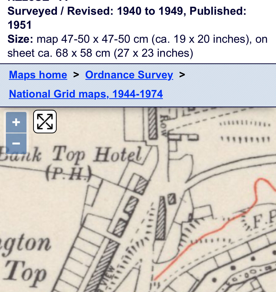
@Alan Edgar (Eggy1948) Thank you 😄 Cragg’s Bdgs comes up a lot in my family history. I’m surprised Puddlers Arms doesn’t have much information about it but I guess if it stopped being a pub in the 1890s it makes sense. I think there might be misconceptions that the Puddlers Arms was *on* the site that the Bank Top Hotel is, when it was a few doors down (I thought this at first 😁). But maps do have Puddlers Arms in one version and the Bank Top in nearly the same place next. So I can see how that would happen. (On another bit, I know there is a Bedlington Facebook group for things like this? Would this info be useful?)
-
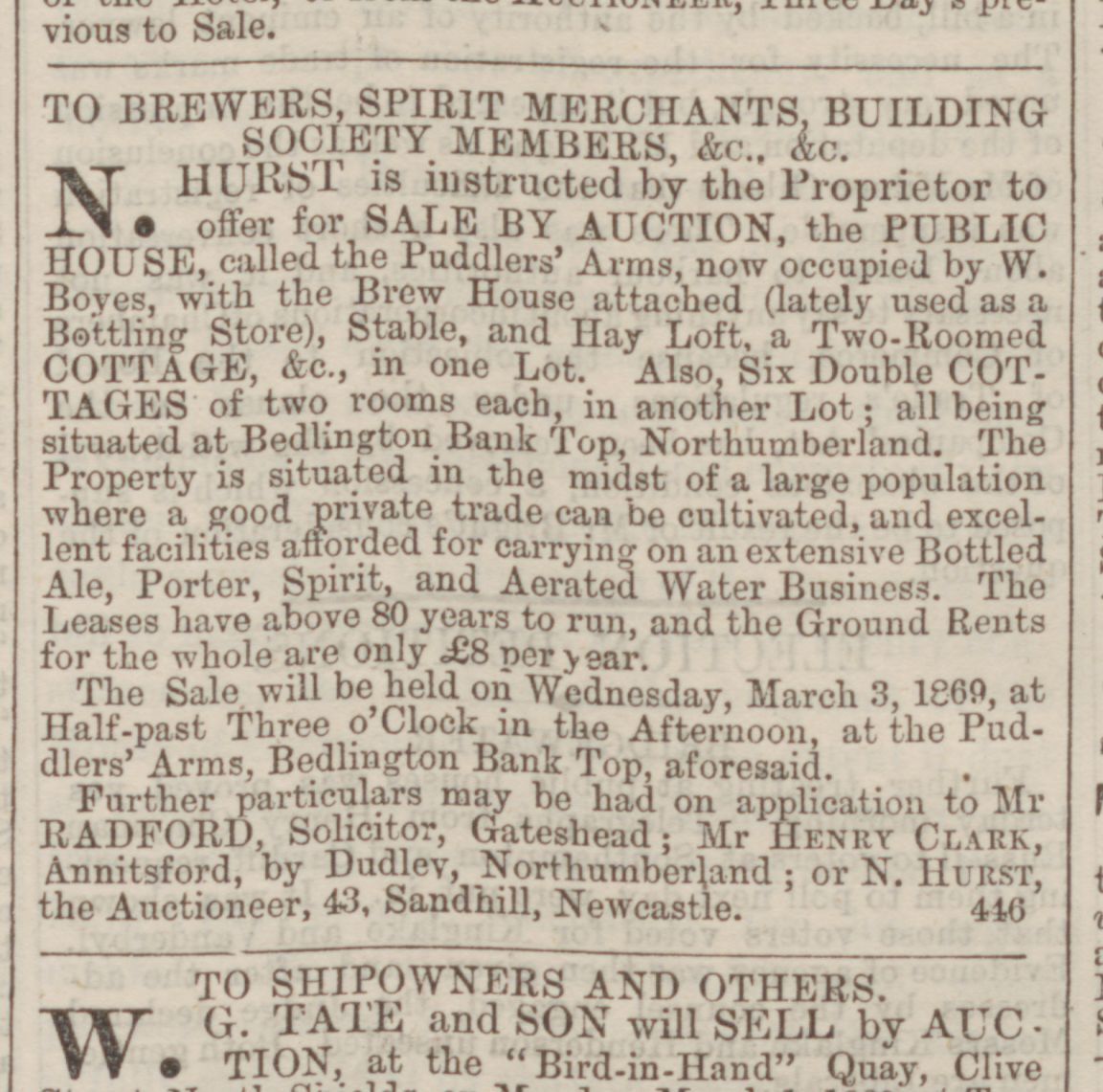
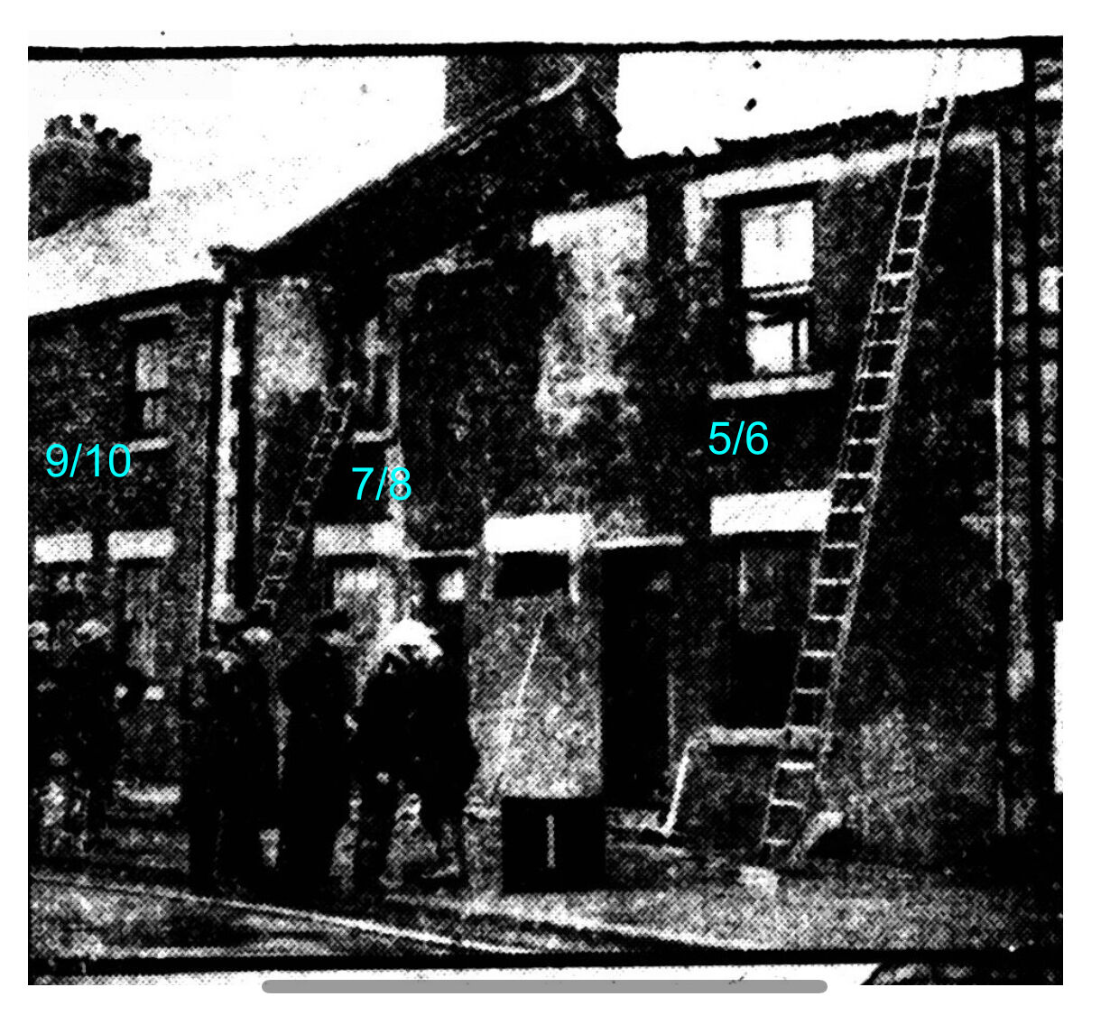
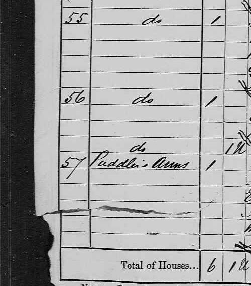
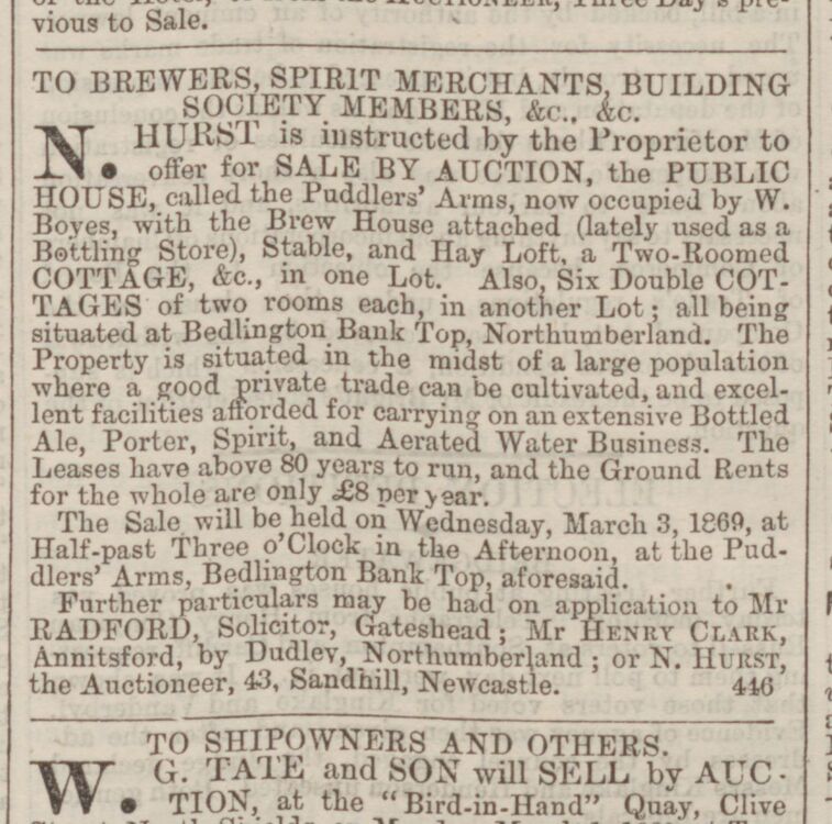
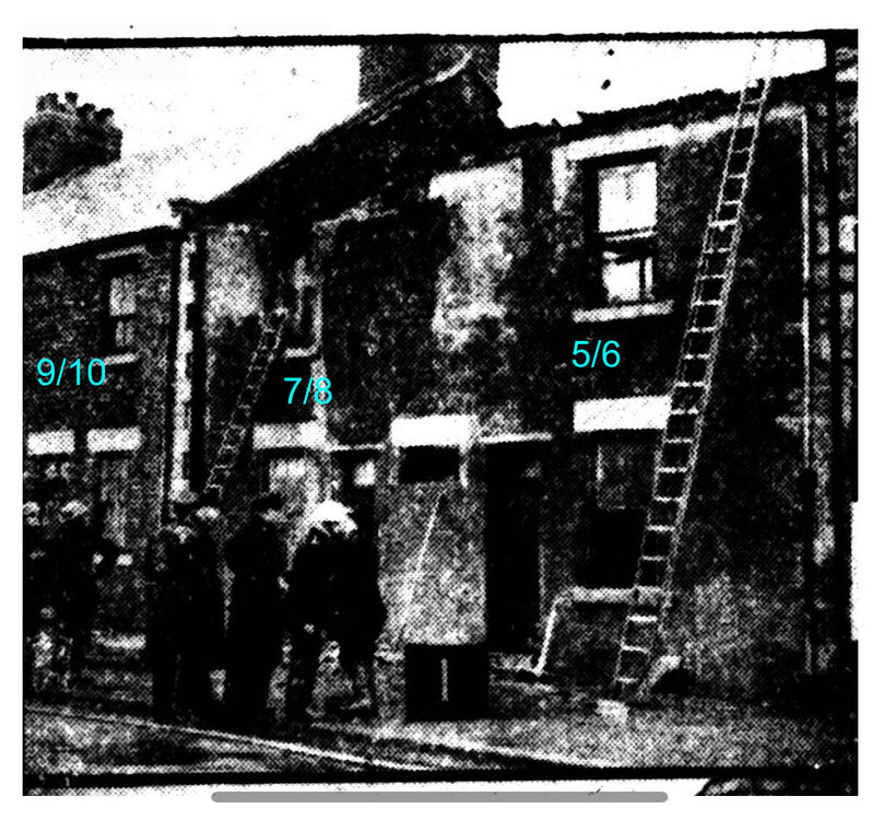
I think this is how Craggs Buildings may have been numbered. It seems it was named this due to the former license holder of the Puddlers Arms being a J. W. Craggs. He had the pub in 1887 before dying in 1889, aged 43. No. 1 started where the Bank Top is now, and continued down to No. 13/14 next to River View. No. 1 - 4 are the cottages that separated the Puddlers from Bank Top Hotel. The 1881 census lists an address “Clark’s Cottages” inbetween “Liddle’s Cottages” (Liddle’s Yard) and “Puddler’s Arms”. I think it’s likely Clark’s Cottages referred to No. 1-4. A former landlord of the Puddlers was Henry Clark. No. 5 - 8, an auction piece on 22 Oct 1864 (Newcastle Daily Chronicle) lists the Puddler’s Arms as having “eight large rooms”. Possibly that the Puddler’s was split into four two-room flats. No. 9 - 14, the same auction piece lists the Puddlers Arms as having “three houses, with four rooms each, adjoining the above.” I believe these were split into the six two-room apartments of No. 9 - 14, as a later auction piece on 27 Feb 1869 (Newcastle Daily Journal) now describes the attached property to Puddler’s Arms as “six double cottages”. Photo with the door numbers included.

-
Possibly this?

-
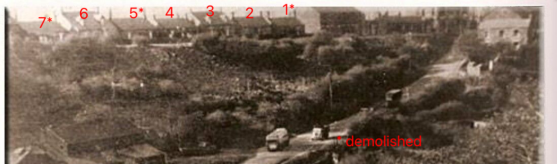
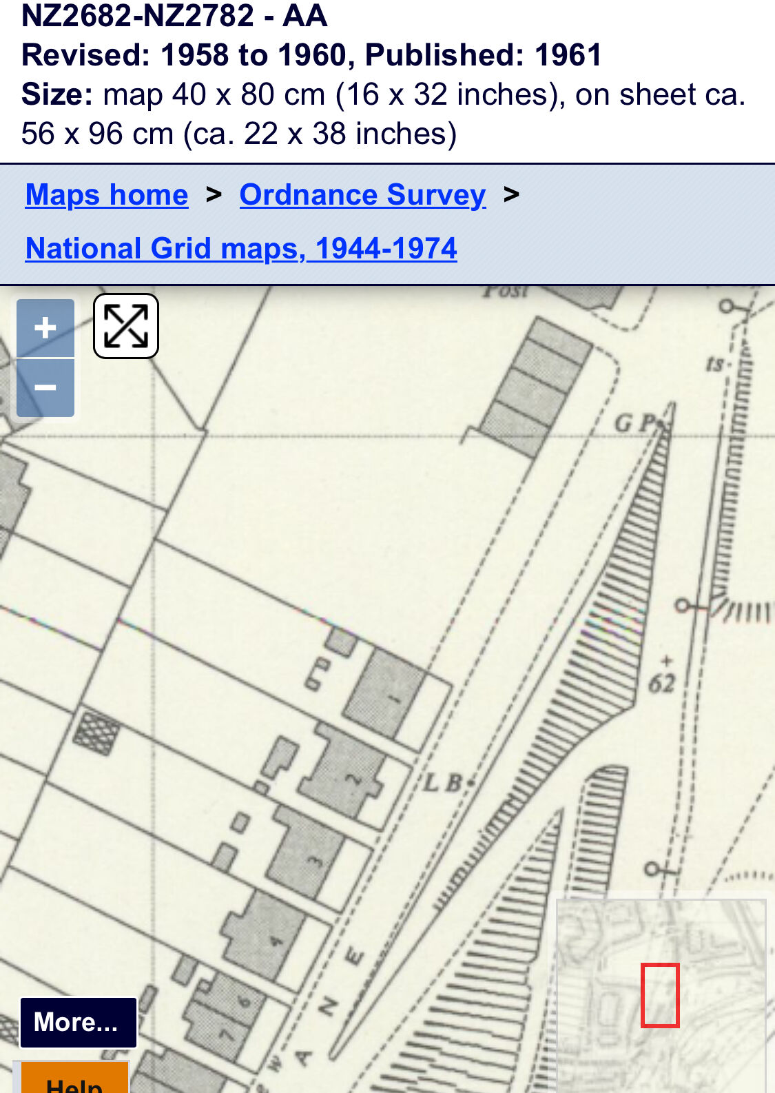
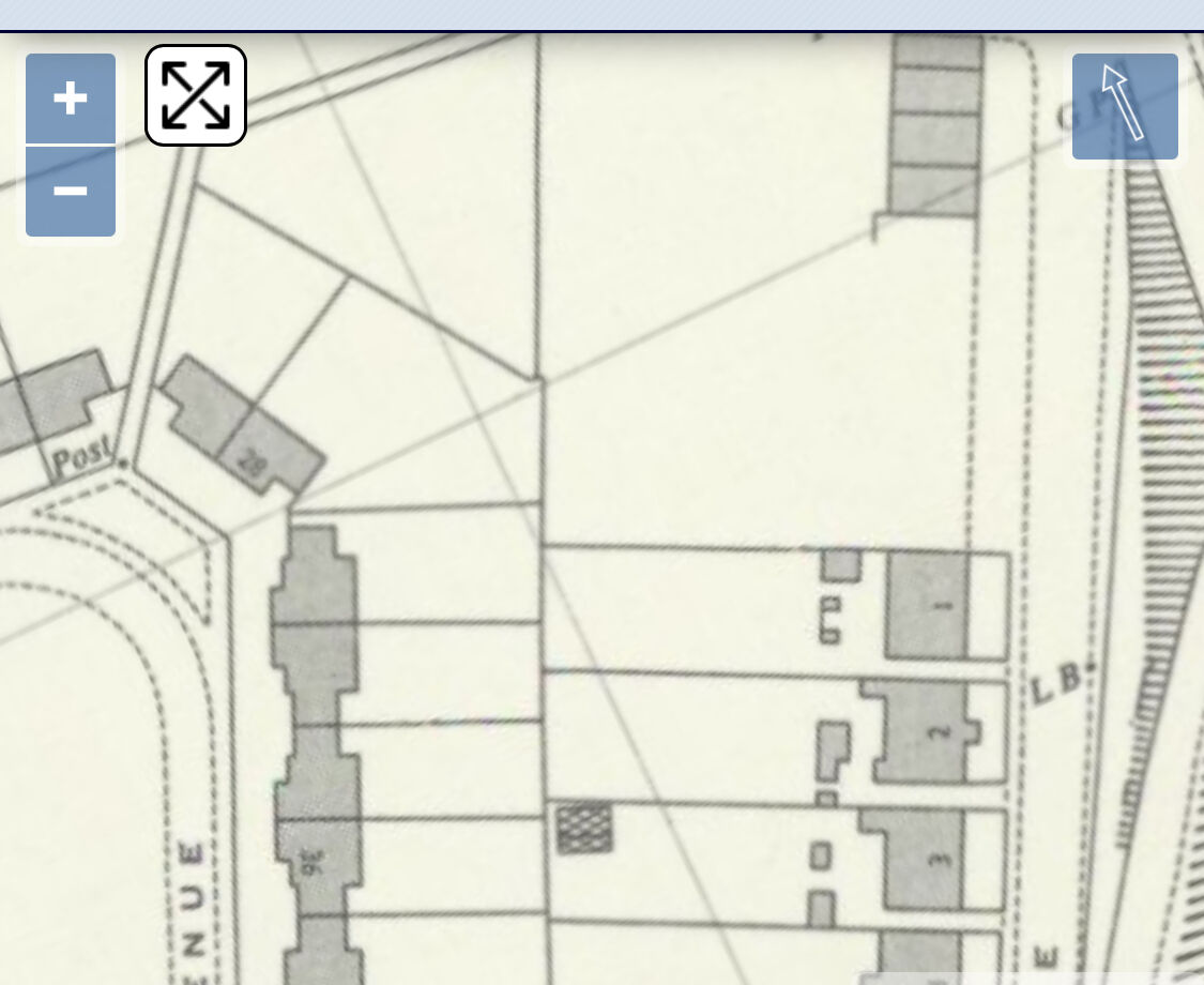
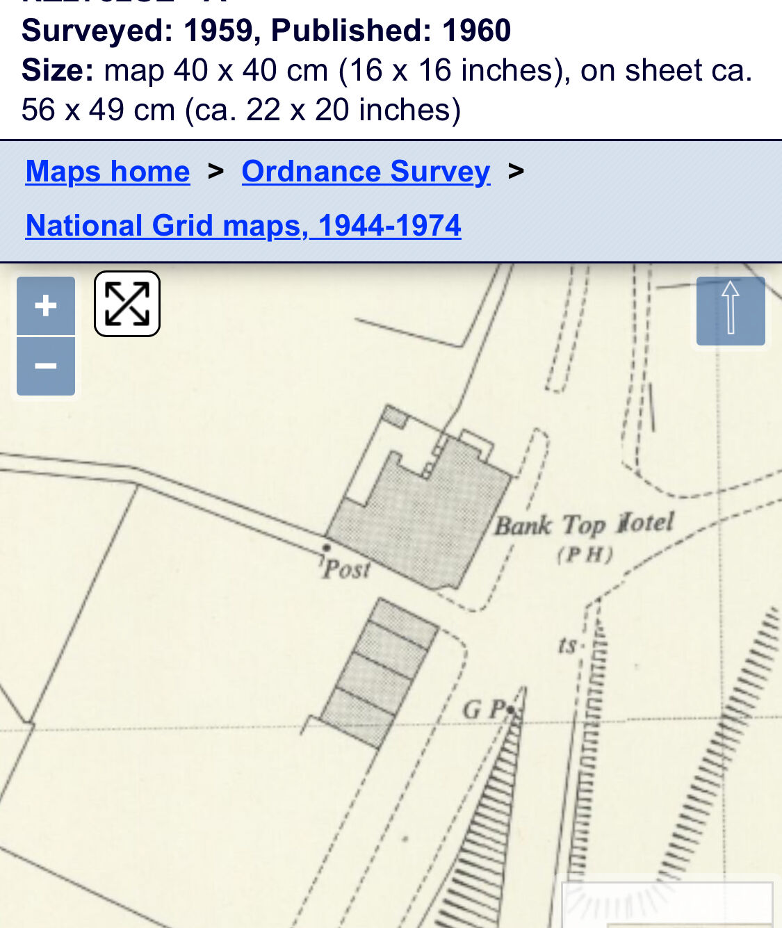
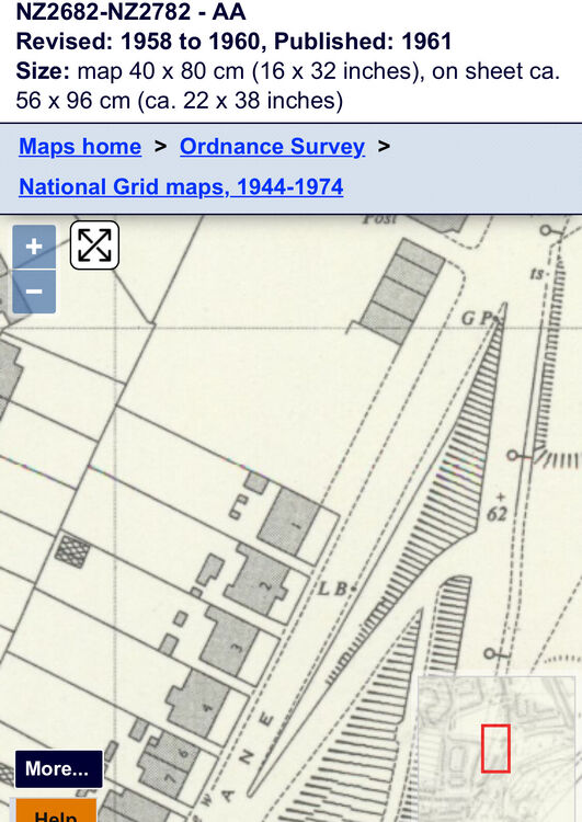
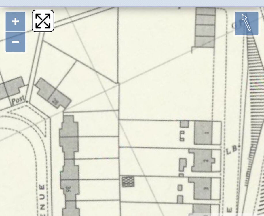
@Alan Edgar (Eggy1948) I think the bungalow you reference as River View in the older picture is actually the second one in, number 2? Maps has a no 1 River View which nearly lines up with a corner house in Tomlea Avenue . But the current end house (2) is a bit further down. I assume a few got demolished over the years.
-
It looks like that between 44-49 (presumably 1944) that the middle block was demolished after the fire but the outer houses kept. Then at some point between 1949 and 1959 the lower houses also demolished, keeping the ones closest to Bank Top Hotel until River View Close was built.