

Contributor Leaderboard
-

threegee
Administrators2Points4,445Posts -
.jpg.cdd7f8371d17e2f2f2e2a0e21e02f727.jpg) 2Points3,654Posts
2Points3,654Posts -
Malcolm Robinson
Moderators1Points6,416Posts -
HIGH PIT WILMA
Members1Points1,519Posts

.thumb.jpg.7493ddab4a696108cf2b849323d3c155.jpg)


Popular Content
Showing content with the highest reputation on 11/02/16 in Posts
-
1 pointIf, like me, you often have time to kill in strange places like hotels and airports wouldn't it be nice to meet up with a friend for a coffee and a natter just to help pass the time? Are you contemplating a visit to some far flung (or not so far flung, as the case may be), foreign country for holiday or for business? Maybe somebody here lives in that country, or has at least visited it, and would be able to offer tips and advice on local customs, food, or places to visit? Maybe you just want to ask a 'silly' question like do I need to bring my own toilet paper or maybe they would like to meet up just to get a bit of news from home or hear the North East 'twang' again? This could be the first stop for you! Post your travel plans, ask for advice on places to visit, things to do and things to see or simply arrange to hook up for a chat. This could even lead to a couch surfing network, who knows! As a starter, I'm at a relatively loose end in Bedlington, Tuesday and Wednesday (9-10 Feb) next week and will probably spend the evening in the Red Lion. It would be nice to meet any of you who are in the area. Do pop in and say hello if your passing that way. I'll Place a rolled up copy of an unmentionable newspaper on the table in front of me. Of course, there may be a chance , or a risk (depending on how you view things) that you encounter the odd intellectual discussion - this is the Red Lion and I am known for my enquiring mind! Favourite topics of conversation with me, just now, are: How many fish must there be before you can call it a shoal? How fast does a caravan go? Mickey Mouse: spherical or flat ears? Wednesday 11 feb, I have 3½ hours to kill in Amsterdam. Anybody about between 12 and 3 in the afternoon?1 point
-
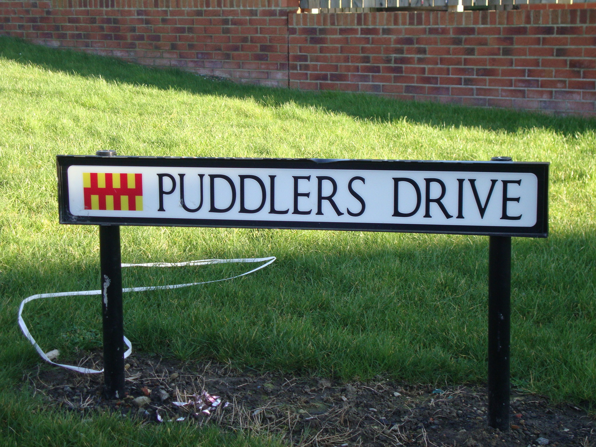
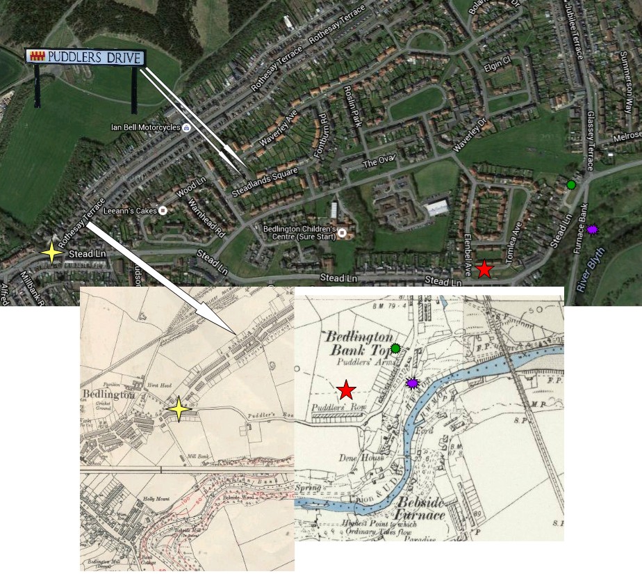
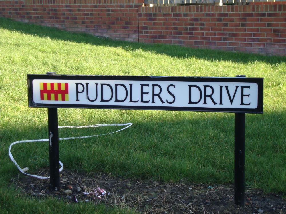
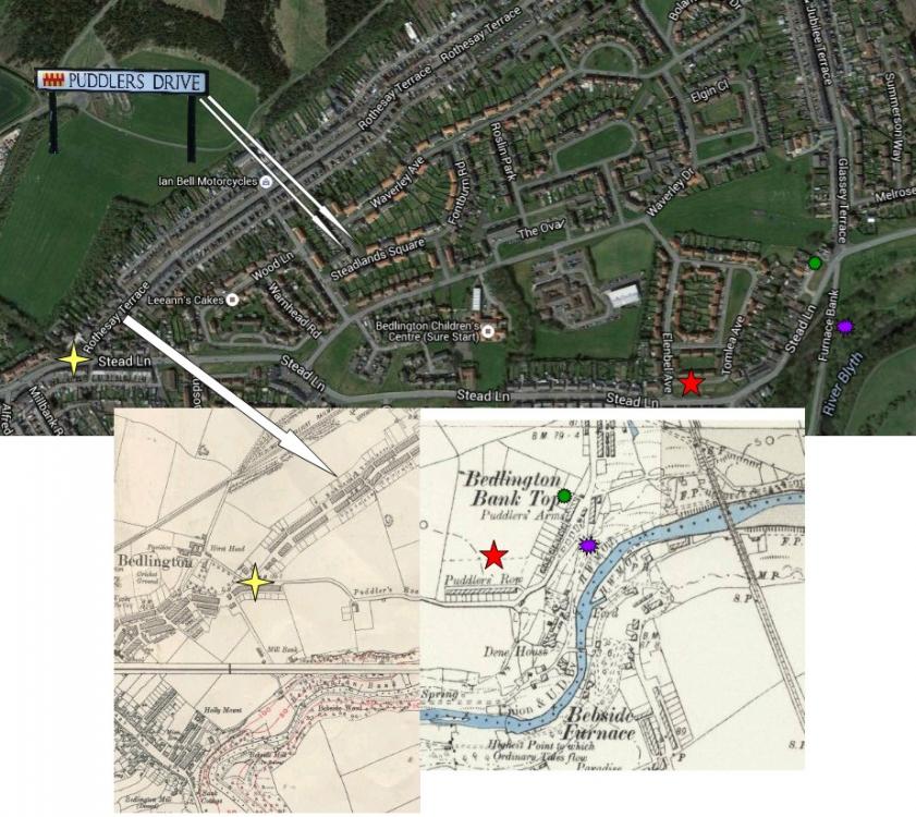
1 pointMaggie - I have never found a load of info on The Puddler's connected to the Iron Works. There again I haven't really looked that far, just via Google! Never found a photo of the type of puddling furnace that was used at the Bedlington Ironworks. From the info that is around 'the puddlers' were a breed of their own, and imported into many steel & railway production areas in England. As the old maps show the name Puddlers was used for roads, houses and a pub. Extracts from a couple of www sites and and a concocted photo to follow :- https://en.wikipedia.org/wiki/Bedlington_Ironworks Bedlington Ironworks, in Blyth Dene, Northumberland, England, operated between 1736 and 1867. It is most remembered as the place where wrought iron rails were invented by John Birkinshaw in 1820, which triggered the railway age, with their first major use being in the Stockton and Darlington Railway opened in 1825, about 45 miles (72 km) to the south. Blyth Dene, near Bedlington, was an idyllic location next to the River Blyth which had all the right ingredients for an ironworks at the time: there were nodules of ironstone in the coal laden banks of the river, there was plenty of wood for the traditional approach of charcoal making, water for driving the hammers, and the port of Blyth was only two miles downriver for shipping of the products. At the time, a Shropshire man, Abraham Darby had started a revolution in ironmaking by using coke instead of charcoal. The Bedlington ironworks originally consisted of two elements – a mill in Bebside and a furnace at Bedlington Mill The ancient corn mill at Bedlington was taken over in 1759 by Malings & Co of Sunderland, who built a blast furnace for foundry work. However they did not do well. Later there was a forge driven by a huge water wheel and a puddling furnace which needed the coal that was all around. http://www.gracesguide.co.uk/Bedlington_Ironworks The dawn of the nineteenth century saw Hawks and Longridge still in command of the Bedlington Iron Works. The discoveries by Abraham Darby, the introduction of the puddling furnace and the rolling mills were all contemporary happenings of the early Bedlington iron workers. The "ironmen" of Bedlington undoubtedly established their trade well into the eighteenth century, by expanding business and spreading the name of the firm. 1855 The locomotive factory was closed down. The cost of transit was far too great, and competition was too much to contend with. The Bedlington Coal Co purchased the iron works in 1865 and traded as Bedlington Iron Co. The intention was to manufacture iron mouldings for their own use and for outside sales. But little was made of it and the iron works were finally abandoned in 1867. Bedlington Coal Company did sell one possession of the Ironworks in 1867 and that was the famous wagon way, which went from Blyth to the Tyne Railway Company. From Bedlington ‘time line’ http://www.sixtownships.org.uk/bedlington-time-line.html 1864 Dixon & Mounsey built twenty-one cottages named Puddlers Row Rootsweb site http://archiver.rootsweb.ancestry.com/th/read/NORTHUMBRIA/2005-06/1119510958 has one researcher giving this info :- The terraced "cottages" that housed the "puddlers" from the Bedlington Iron Works were called Puddlers Lane, Row and Road. Today they are Stead Lane and Jubilee Terrace. Today's "Bank Top Hotel" was once the Puddlers Arms. To get "half" a view of the area, go to >communities.northumberland.gov.uk< choose "Bedlington", from left hand menu, click on "Ordnance Maps" The 1st Edition 1860 6" map showing the town/village of Bedlington only shows a wee bit of Bedlington Station, and the Ironworks. See it at extreme right hand of map. See Puddlers Row, running north from Furnace Bank to the Railway Station (Jubilee Terrace today.). The un-named road running west from Bank Top to Bedlington proper, was to become Stead Lane. Although the map does not make it clear, this lane was on the very edge of a gorge, running down to the River Blyth. At one time this was known as Puddlers Lane. Area is also to be seen on 2nd edition 6" map of 1897. Apity that map are focused on Bedlington, and not Bedlington Station. And an extract from a newsletter on the http://www.eastbedlingtonpc.org.uk/ site by Councillor Allan Stewart :- Councillor Allan Stewart, Chair of the Environment Working Group commented that “the Puddlers are now more accessible to parishioners with mobility problems allowing them to enjoy the swathes of daffodils in the spring and the floral displays in summer”. He added “for those unfamiliar with the local name for the Stead Lane, a ‘Puddler’ was involved in the process of puddling which turned pig into wrought iron and has an obvious connection with the former Iron Works nearby”. And finally my image concoction - extracts from two old maps and although they do not join perfectly most of the relevant info is still there + current google aerial view of the new houses - Coquetdale, Steadlands Square, Tosson Close & the location of the two PUDDLERS DRIVE street signs :-
 1 point
 -
Wow you've been on overtime there TGH! You say you believe in democracy and then you say "TGH-proposal: We stay IN and GET IT SORTED OUT…". How do you think that is going to happen? The EU is fundamentally undemocratic, and it is almost entirely top down. Policy is made by the commissioners, not by our MEPs, so there's no point in berating our North East MEPs - they are only there to give the illusion of democracy. Those are our overlords led by Herr Juncker in the middle. No one elected them, and no one can dismiss them in the way you advocate! They are mostly failed politicos who've made a mess of running their own countries, and have been slung out of office by their respective electorates. Voting to stay in plays right into their hands. This is likely the only opportunity we have to say no, and if you throw it away you've given them the approval they need for their post-democratic society. Amongst other things these people have removed a democratically elected PM in Italy, and installed their own puppet, and will do the same elsewhere. They pay no heed to referendum results, and keep putting the same question in different ways until they get the answer they want, because these elitist post-democrats know better than any electorate. Thanks for the TTIP link. I'm not an Indy reader, but their view accords with mine, and they are - of course - dead right! This is yet another reason any informed person can only vote leave! I'm sorry you don't know about EFTA. We used to be EFTA members and it worked very well for us. I remember sending stuff from Bedlington Post Office to Scandinavia with a very minimum of form filling, and no worries that they buyer would get stuck for any extra charges or have customs hassle. It's actually what we were promised the EEC was, but we were lied to! At the time I couldn't understand why we were turning our back on our EFTA partners, because I took what the politicos were saying at face value. The possibility that Ted Heath was lying through his teeth never entered my silly young mind. If you want to legitimise those lies go right ahead and vote IN, but you'd be making a huge mistake that our children and their children will have to face the consequences of.1 point
-
1 pointHeh heh! It's amazing whaat HPW can dae eh!! Aav got a lot o' pull wi thi planning department ye knaa.........whaat AAA say...... gaans!!.....[ownly it shudda sed "Puddlaa's Raa" !!] Thanks for daeing thi research,and posting thi info!1 point
-
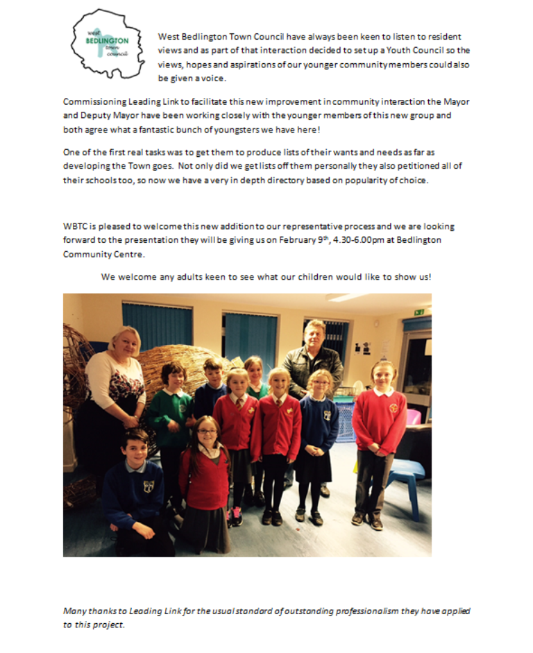
1 pointThanks Malcolm! I really believe that this is the way to go. Children are an extremely underestimated Group in society today. I also believe that getting them involved in community development at an early age, as this and the BiB Project do, will do a great deal to reduce the problems we have with the teenage population in future years. I don't think we will see dramatic results in the very immediate future but this idea is long term planning at it's best. By including children in this way we are taking the first steps in teaching them that life is not all about 'getting' it's also about 'giving', thatl ife is not just about having 'rights', it's also about having 'responsibilities' and it doesn't harm them to learn about simple budgeting either, that everything we want isn't always possible to get whether that be on a personal or a Community level..1 point
-
1 point1 pointI don't see that 3 minute clause anywhere in the contract @Canny lass! And, don't blame the shipper when your delivery office has a long queue - change your mail handler! If you can't guess your own password then it's probably the right password, and you'd be moving in the wrong direction. Anyway, please send me your bank account number - purely for testing purposes. Writing passwords on scraps of paper is something else that went out in the middle ages. Use a secure password manager like Lastpass. They are generally free on a PC, and there's a small sub for the mobile platform. If you use it on both platforms then the magic increases exponentially. Password change? Have a look in your control panel and you'll find all sorts of interesting settings, including resetting that. If all else fails then PM a moderator - THAT will take more than 3 minutes though.1 point