Alan Edgar (Eggy1948)
Supporting Members-
Posts
6,871 -
Joined
-
Last visited
-
Days Won
350
Content Type
Forums
Gallery
Events
Shop
News
Audio Archive
Timeline
Everything posted by Alan Edgar (Eggy1948)
-

1959 from Evan Martin book.jpg
Alan Edgar (Eggy1948) commented on Alan Edgar (Eggy1948)'s gallery image in Sports
-
-
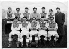
From the album: Bedlington Mechanics FC
-

Bedlington Mechanics FC
Alan Edgar (Eggy1948) commented on Alan Edgar (Eggy1948)'s gallery album in Sports
-
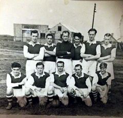
From the album: Bedlington Mechanics FC
-
-
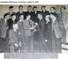
From the album: Bedlington Mechanics FC
-
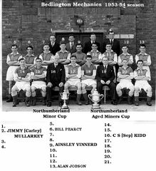
From the album: Bedlington Mechanics FC
-

Good Jokes: Not For The Faint-Hearted (Adult content)
Alan Edgar (Eggy1948) replied to a topic in Chat Central
No jokes young lady, just some links to Youtube videos that might make you smile :- -

c1952 from Julie Dobson named.jpg
Alan Edgar (Eggy1948) commented on Alan Edgar (Eggy1948)'s gallery image in Historic Bedlington
-
@Brian Cross :- would you like me to ask on the Bedlington Facebook groups - Bygone Bedlington & Bedlington remembered if anyone knows of a David Walker from Milbank Road or the surrounding area. If you do is there any other info that could be added, eg. age, that might help?
-
untilWoodhorn Museum - Woodhorn, QEII Country Park, NE63 9YF Ashington, Northumberland. Info posted on the Woodhorn Museum site :- Woodhorn Museum Yesterday at 12:30 · It's almost time for the Northumberland Miners' Picnic 2019! Here are some of our top tips to help you have a fantastic time at the event on Saturday: 🌦 What to wear...well...it's the British summertime so prepare for all eventualities! We recommend layers, waterproofs and sunscreen to make sure you are comfortable throughout the day! If you bring a brolly just remember it's a busy day and be mindful of those around you, particularly around the main stage area. 🤷♂️What to bring? You are welcome to bring your own picnic blankets and camping chairs as the deck chairs provided are limited and fill up fast. You're also welcome to bring your own picnic or enjoy food & drink from our fantastic street food suppliers or cafe. Please help us to keep tidy by using the bins provided and do not bring your own alcohol onto the museum site. 🚶♀️🚌🚗🚴♂️Getting here? Find full details in the 'about' section, but it's a busy day so if you live near & can walk here - great! If not we run a park & ride service from the former Alcan site (follow the AA road signs) and also a shuttle bus from Ashington Leisure Centre. We also have limited cycle racks on site. Parking on site at the museum is reserved for blue-badge holders or other visitors who really need to park nearby (e.g. parents with buggies etc). If you're not sure, just ask a member of staff for help. Parking is £5 per vehicle. Please allow plenty of time to get here & to get home on this busy day. 🐕 Four legged friends? Well behaved dogs on leads are allowed in all of the museum's outside spaces but not into our main museum building. (Assistance dogs are permitted everywhere). Picnic day is busy and noisy so please bear this in mind when deciding whether to bring your pet along. Please do not leave dogs in cars. 💁🏻♀️The Northumberland Miners' Picnic is a free community event run by Woodhorn Museum (Woodhorn Charitable Trust) and supported by Arts Council England, Ashington Town Council and Northumberland County Council. There is a charge for parking which goes a small way to covering the cost of the event. The facepainting and pony rides activities are available at a small cost, all of the other activities and performances are free of charge. Please donate whatever you can spare on the day to help support us being able to continue bringing free events to Northumberland! If you have any questions or concerns during your visit we have plenty of staff on hand to help. Don't hesitate to ask for information or help so that we can do our best to make sure you have a fantastic day out! See you on Saturday!
-

Bates Colliery - Blyth
Alan Edgar (Eggy1948) replied to Alan Edgar (Eggy1948)'s topic in History Hollow
HIGH PIT WILMA - did you notice Michelle had joined this group? Try a PM on this group and see if she picks it up. I can tell her via the Cambois Facebook group when you have PMed her -

Bates Colliery - Blyth
Alan Edgar (Eggy1948) replied to Alan Edgar (Eggy1948)'s topic in History Hollow
@HIGH PIT WILMA - did you notice Michelle had joined this group? Try a PM on this group and see if she picks it up. I can tell her via the Cambois Facebook group when you have PMed her -
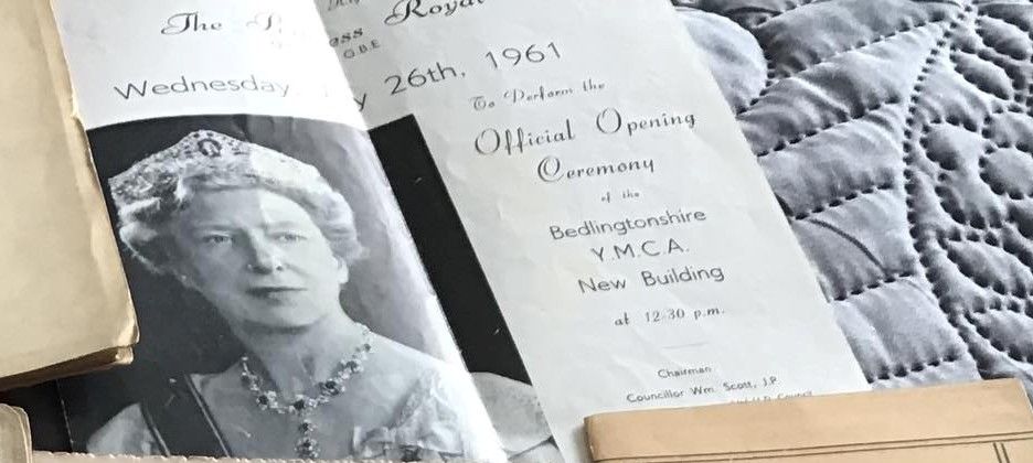
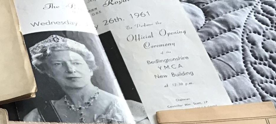
@Pete - just checked th1 1961 calendar and the 26th May 1961 was a Friday - 26th February was a Sunday but the 26th July was a Wednesday
-
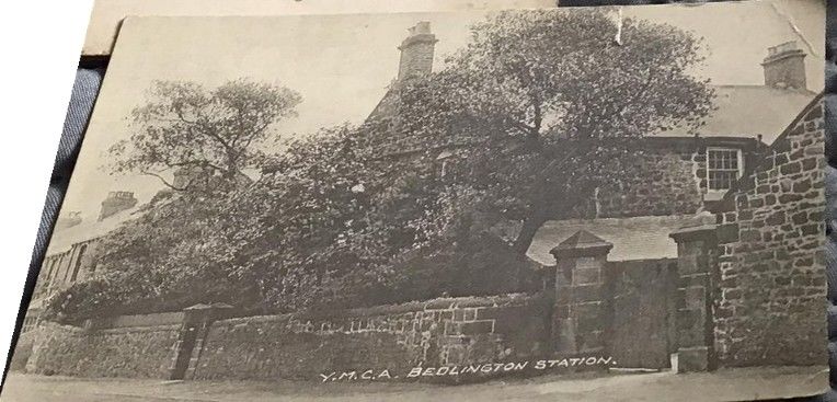
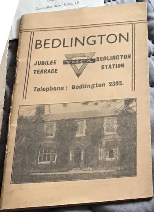
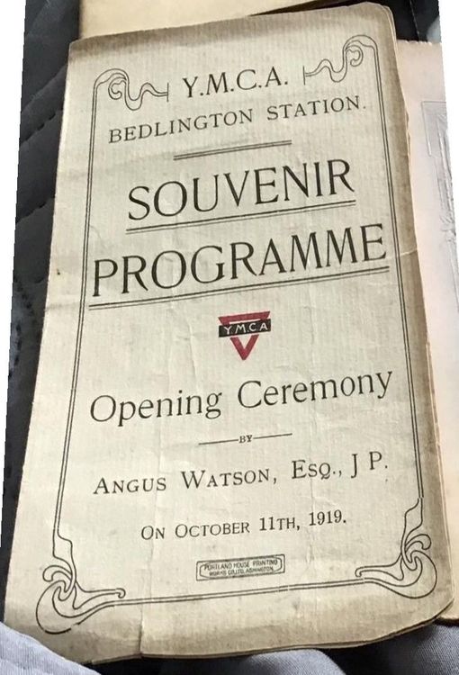
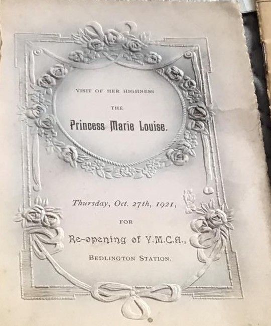
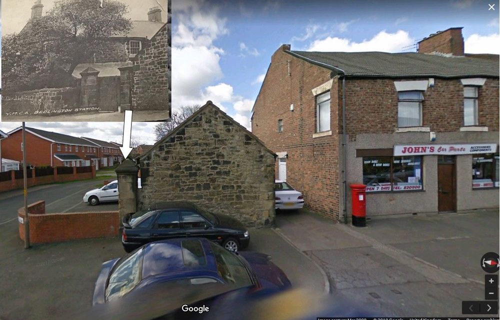
@Pete - Edit Barrett - Facebook group Bygone Bedlington posted this comment this evening :- Found these when clearing a late relatives house, some very old programs. If anyone is interested in buying them message me. No silly offers Along with that comment this image :- I have extracted some of the images but can't straighten them up :- And Google street view showing the bit that still exists = Jubilee Mews :-
-
I have very simplistic views. If the housing is affordable and people wan to live in their own house, with all their own facilities, then nothing wrong with terraced housing = good soundproof insulation. After that then I would say it's all down to the tenants - some will mix respect their neighbours and some will not. I doubt that will ever change whether it's terrace, semi or detached housing.
-

Netherton school from James Lee Aynsley.jpg
Alan Edgar (Eggy1948) commented on Alan Edgar (Eggy1948)'s gallery image in Historic Bedlington
-

Bates Colliery - Blyth
Alan Edgar (Eggy1948) replied to Alan Edgar (Eggy1948)'s topic in History Hollow
No response off the others sites, yet, Bill. Health - I work on the basis that I enjoyed myself getting to this state so I just have to put up with the consequences . I always keep an eye oot for you when I pass through Bomarsund as I expect to see you + dog outside your bungalow - near the bus stop? -

1955 West End primary from Janice Robinson.jpg
Alan Edgar (Eggy1948) commented on Alan Edgar (Eggy1948)'s gallery image in Historic Bedlington
-

1980 Class 1-2 named.jpg
Alan Edgar (Eggy1948) commented on Alan Edgar (Eggy1948)'s gallery image in Historic Bedlington
-

1955 West End primary from Janice Robinson.jpg
Alan Edgar (Eggy1948) commented on Alan Edgar (Eggy1948)'s gallery image in Historic Bedlington
-

1955 West End primary from Janice Robinson.jpg
Alan Edgar (Eggy1948) posted a gallery image in Historic Bedlington
From the album: West End Junior school - Ridge Terrace
-

Marshall's Buildings - Front Street East
Alan Edgar (Eggy1948) replied to Alan Edgar (Eggy1948)'s topic in History Hollow
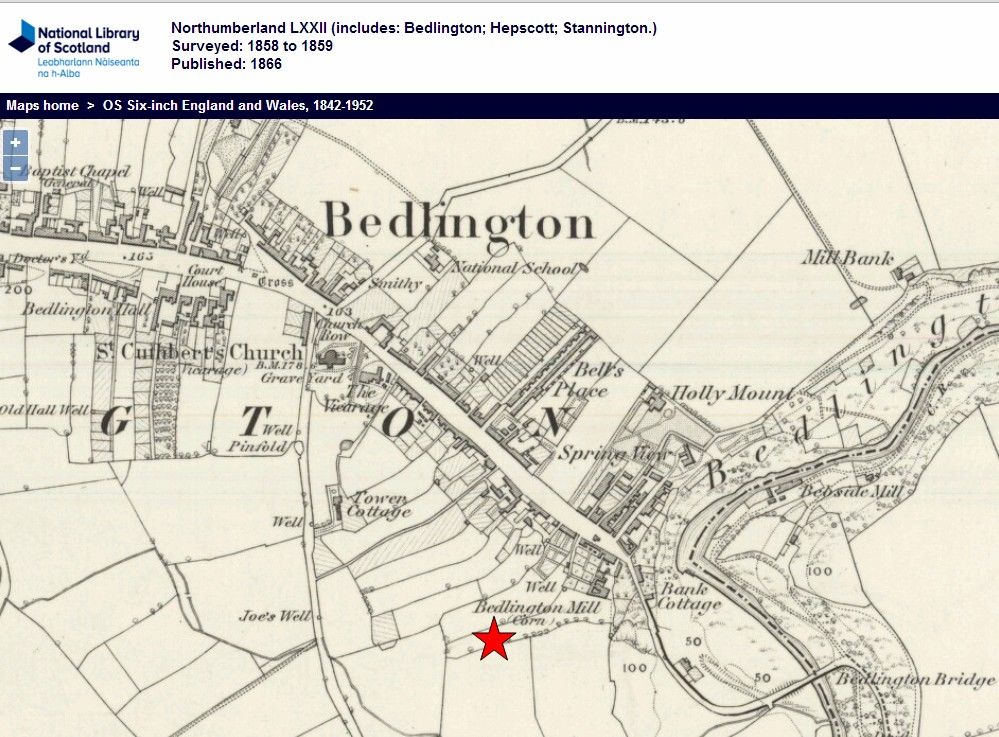
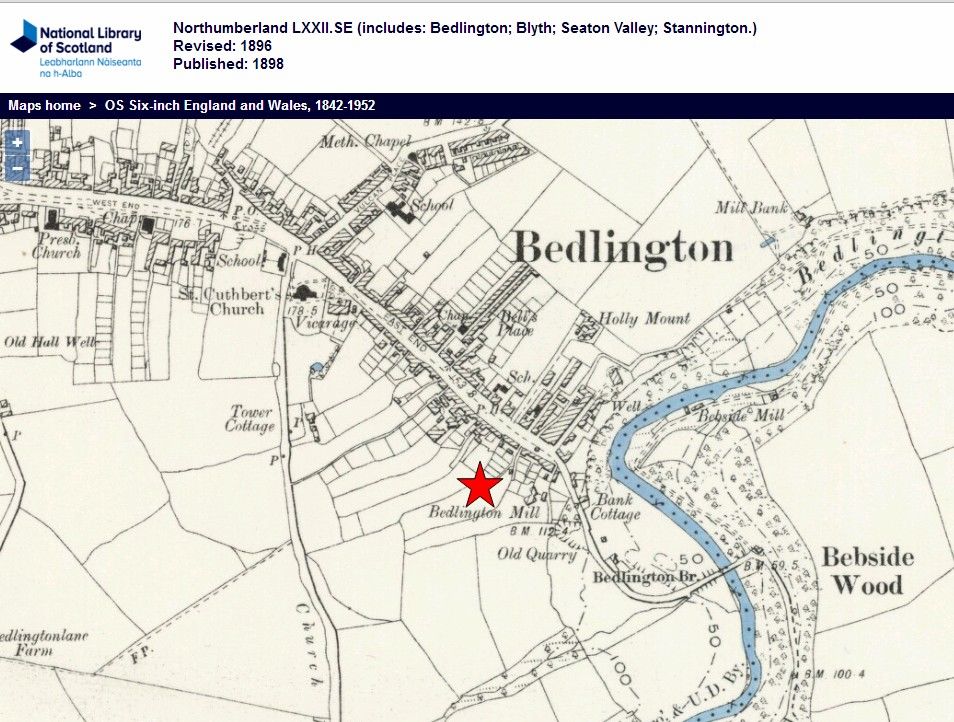
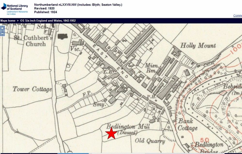
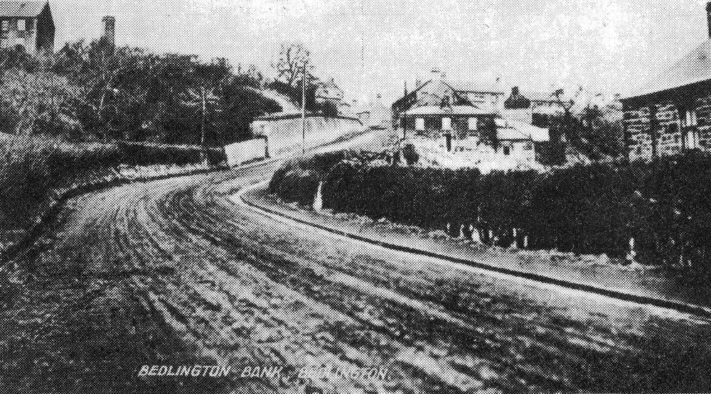
@Jack be - don't know anything about Wright's the Bakers. The Bedlington Mill (Corn) is identified on the maps produced in 1866 and 1898 and then the 1924 map states Bedlington Mill ( Disused). The only photo that I have seen that shows part of the mill building(s) is one without a date from the bottom of the Bedlington Bank and you can see a chimney - top left.


