Contributor Leaderboard
-
.jpg.cdd7f8371d17e2f2f2e2a0e21e02f727.jpg) 4Points3,645Posts
4Points3,645Posts -
1Points6,969Posts
.thumb.jpg.7493ddab4a696108cf2b849323d3c155.jpg)

Popular Content
Showing content with the highest reputation on 10/02/25 in all areas
-
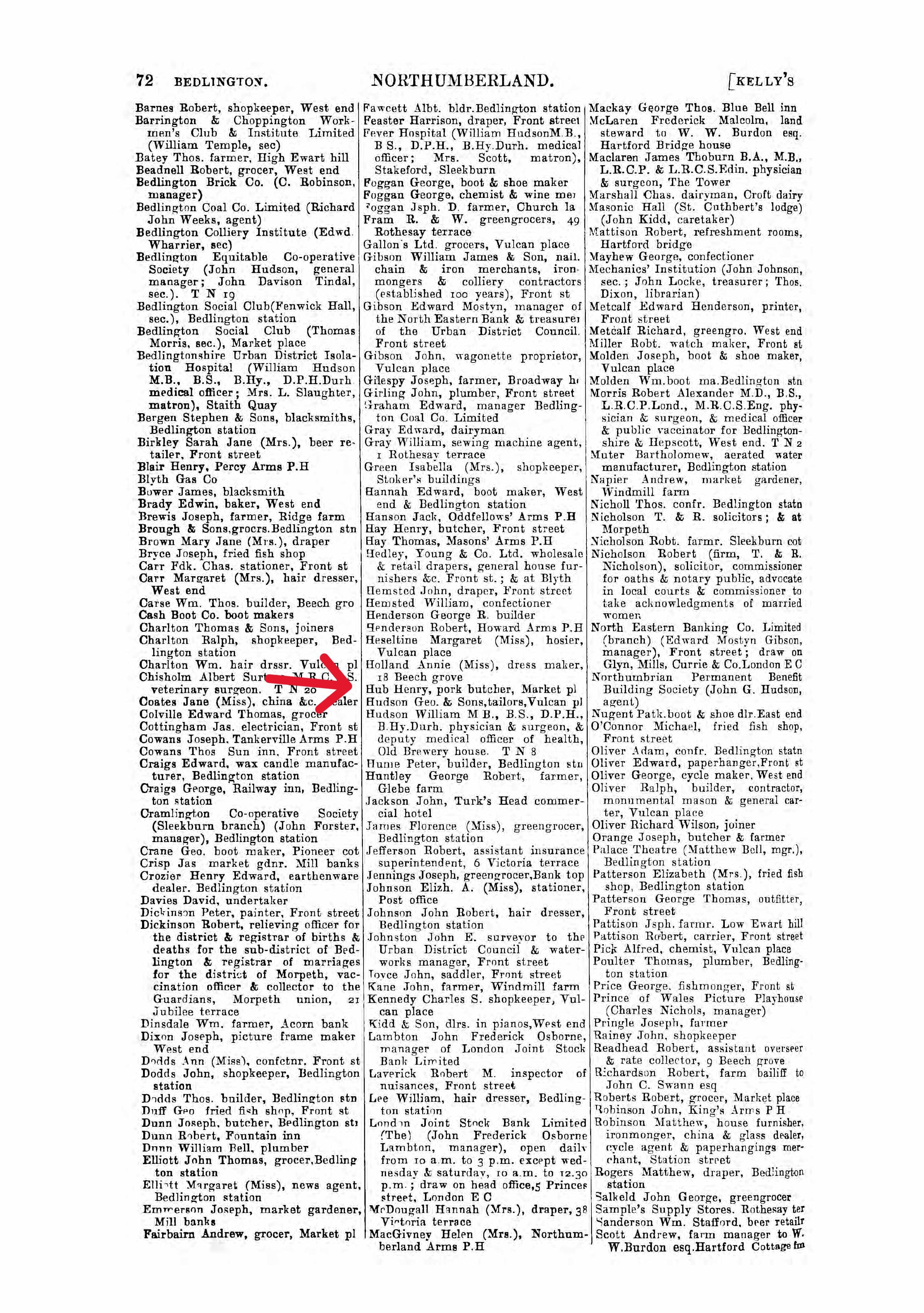
PS Your great grandfather was still at the same address in Bedlington in 1914, before moving to Walker, Newcastle. His business appears in Kelly's Directory of that year.
 2 points
 -
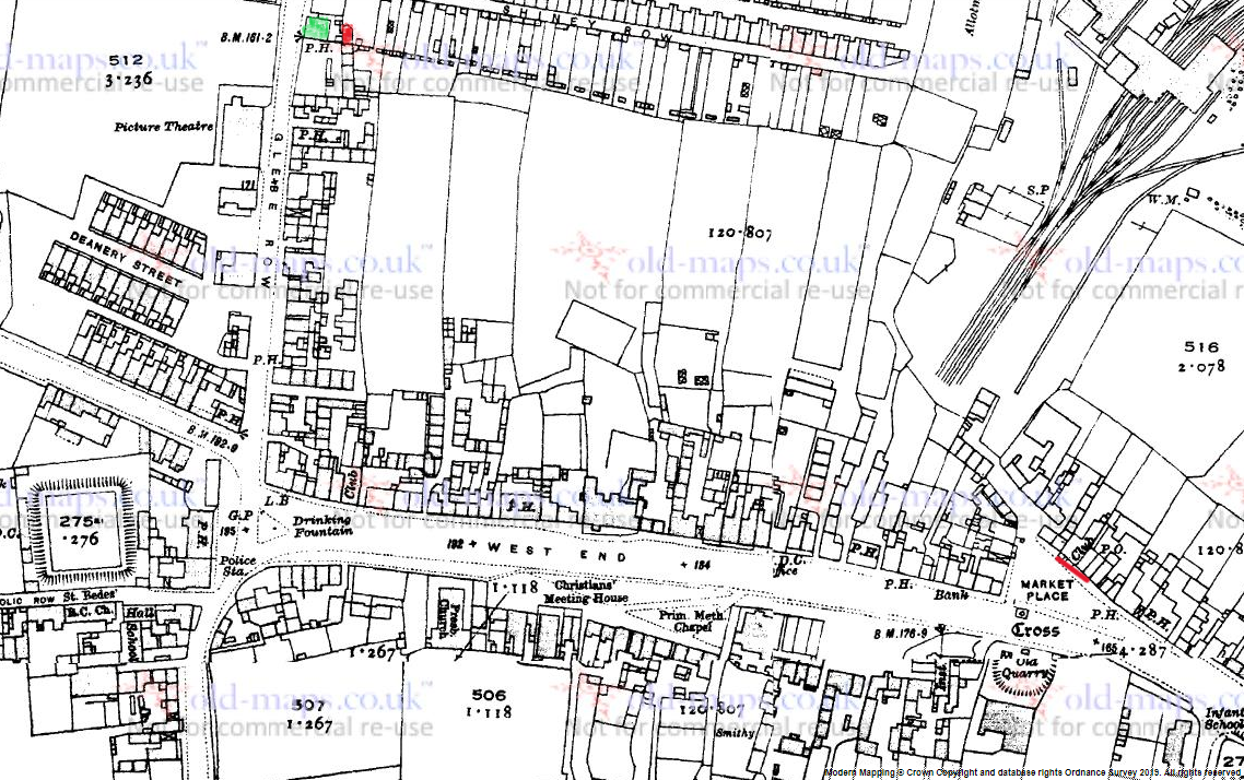
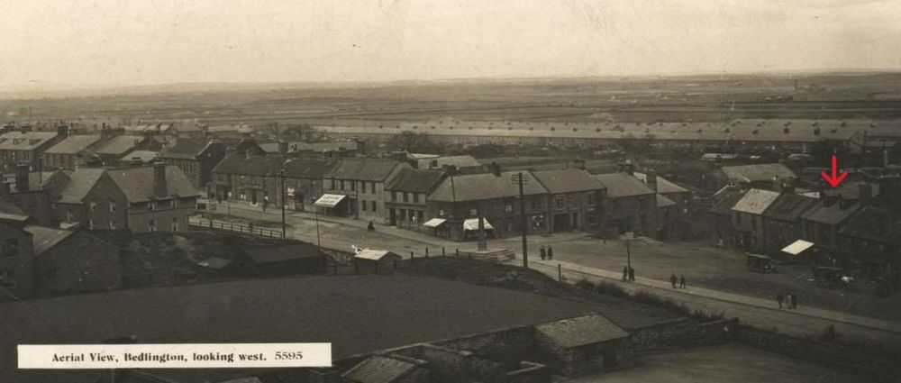
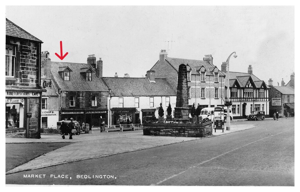
Hi @Richard Norton and welcome to the forum. Here is a map f and some photos that might interest you. The map is from 1922. In 1911 Henry was living and working in the building located between the Post Office and the Workingmen's Club. I've underlined these in red on the 1922 map so you can see the approximate area within the Market Place. In the following photo of the Market Place (1930) I've arrowed the house in which Henry lived and worked - the one with the white awning. I have no idea if he rented or owned the property but as he states that worked "at home" it's safe to say he lived on his work premises. The building is easy to locate from the 1901 and 1911 census records where it is always in the same location in relation to The Turks Head public house (the first PH to the right of my red line on the map). This next photo, date unknown) shows the market place from a different angle. I've arrowed the building again and you can clearly see the Post Office to its right, though Hub's Pork Butchers has now become Kiddies Corner. The Tudor style building to the far right is the Howard Arms. The larger building to its left is the Turks Head. The Fish & Chip shop to the left of Henry's house was previously the Workingmen's club - Henry's neighbour in 1911. I hope this is of some help.
 2 points
 -
1 pointNorthumberland County Council – Application Summary Help with this page(opens in a new window) 25/00401/FUL|Extensive refurbishment/renovation of long disused station building to create community cafe/bistro|Former Railway Station Building Park Terrace Bedlington Northumberland NE22 7JW https://publicaccess.northumberland.gov.uk/online-applications/applicationDetails.do?activeTab=summary&keyVal=SQWSU2QSH6N00&fbclid=IwY2xjawIW2DBleHRuA2FlbQIxMQABHcerva0txBiBYihgxESAakjLi1swdMt-ILD2itlpDav_wAtzqyxlY0AgsQ_aem_Z1GcLcnG1iladtGoXOYDpQ1 point