
Contributor Leaderboard
.thumb.jpg.7493ddab4a696108cf2b849323d3c155.jpg)

Popular Content
Showing content with the highest reputation on 07/03/25 in all areas
-
@Canny lass & @Harry.T.S this is just me trying something different. This is a direct link to a 202 map on the NLS site, same period as the 1921 map CL posted above, but a bit more detail :- https://maps.nls.uk/view/1322789811 point
-
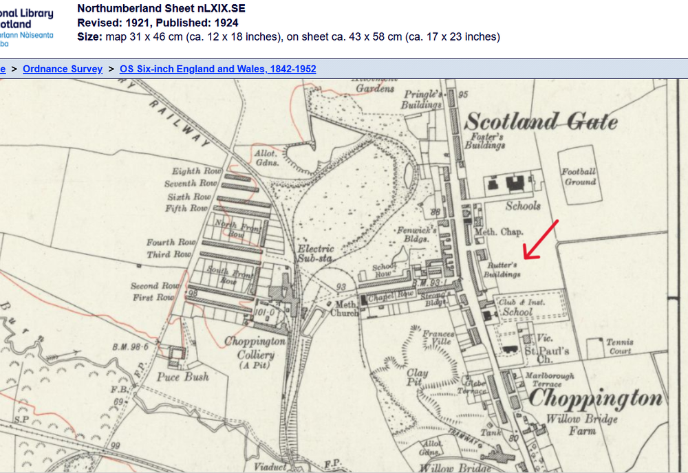
Hi @Harry.T.S, welcome to the forum. As I said I’m not too familiar with the area but Rutters Buildings starts to appear on maps at some point between 1866 and 1896. It was a long row of housing lining the main road at Scotland Gate (between Choppington and Guide Post). In the 19 11 census there were 15 families living in Rutters Buildings. 13 of them were living in just 2 rooms and the remaining 2 families had 3 rooms each. There were some big families so living conditions for most were cramped, to say the least. Rutters buildings was located between the methodist church at the north end and the Kings Arms public house which adjoined the terrace at its southern end. You can see it on this map from 1924 which is the earliest on which I find its name but there may be others.
 1 point
