.jpg.cdd7f8371d17e2f2f2e2a0e21e02f727.jpg)
.jpg.a8059e59bff91bf6691d0bfedf8fad60.jpg)
Everything posted by Canny lass
-
Answers to last week's quiz: 1. 16th 2. St Stephen 3. 8 (No Rudolph) 4. The ghost of Christmas to come 5. Because of his red nose 6. Germany 7. Clockwise 8. A hen 9. True 10. Radishes 11. Mince Pies 12. John Horsley 13. Canada 14. 12 15. Silver 16. Of course there is. Who do you think does all the organizing and present wrapping! 17. England 18. Norway 19. NORAD :North American Aerospace Defense Command. Started 1955 20. The Christmas Song
-
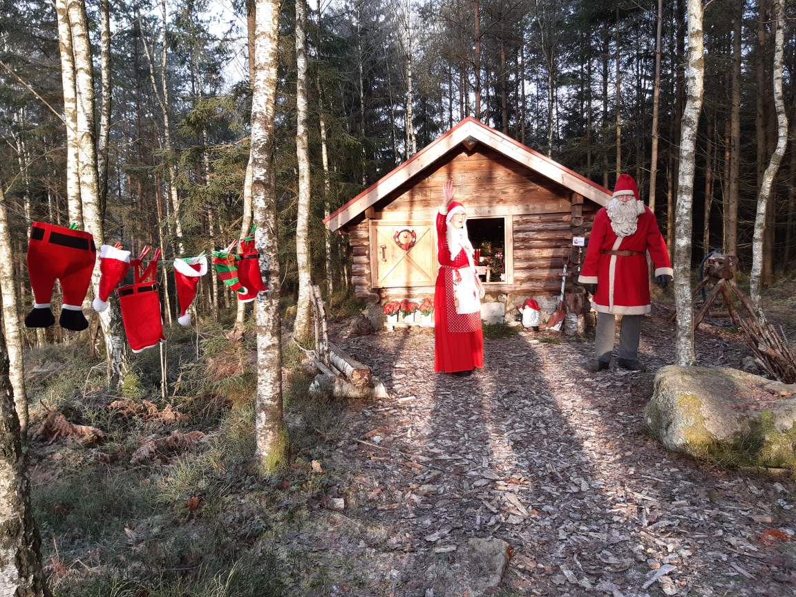
No, Covid hasn't taken a grip on us again (yet), I just thought you should have something to keep you out of mischief while I'm celebrating Christmas here today, one day earlier than you, as is the tradition. It might even keep you out from under the feet of those slaving away in the kitchen up to their eyes in brussel sprouts, mince pies and turkey giblets. There is no (well, not much) Covid but you're still allowed to use the internet so get yourself a drink, put your feet up and get cracking! Christmas special: In which century was the term ‘Xmas’ coined? Which saint is celebrated on 26th December? How many reindeer feature in the poem ‘Twas the Night Before Christmas’? What is the name of the last ghost to visit Scrooge in ‘A Christmas Carol’? Why did the other reindeer laugh at Rudolph? Stollen is the traditional fruit cake of which country? In which direction should you stir sweet mincemeat for good luck? What is a female turkey called? Before turkey, a traditional English Christmas dinner included a pig’s head smothered in mustard. True or false? Part of the Christmas celebrations in Oaxaca City, Mexico, is Noche de Rábanas. Which food gives the festival its name? Which Christmas food is considered to bring good luck if eaten on all of the twelve days of Christmas? Who designed the first Christmas card, sent in 1843? Which country is the largest exporter of Christmas trees? How many days do we have between Christmas and the Epiphany? Which of the following was NOT a gift given by the wise men to the baby Jesus: Frankincense, silver, myrrh, gold? Is there a Mrs Santa Clause? Which country is credited with the Christmas beverage Eggnog? From which country is the Christmas tree, traditionally placed in Trafalgar Square, London, a gift? Who tracks Santa’s location on Christmas Eve? Bonus point for when it started. In 1946 Nat King Cole recorded a song about “chestnuts roasting on an open fire”. What was the name of the song? I’ll bet you didn’t know …. Prior to the turkey being introduced as Christmas fayre, people ate geese, boar’s head and even peacocks at Christmas. Henry VIII was the first to enjoy a turkey on Christmas day. Answers on Thursday next week.
-
Wilf? here's me calling him Alf! Will he ever forgive me! That's what two weeks in Tenerife have done for my memory!
-
You lot and your sooty chimneys! It takes me ages to get the washing dried when my man's been to your place! But he assures me he'll manage to squeeze himself in again this year - and he's promised me a tumble dryer for Christmas! We wish you all a very merry Christmas, loads of turkey, heaps of mince pies, many chunks of Christmas cake, lashings of brandy butter and rum sauce, mulled wine in abundance, two alka-seltzer and a couple of Rennies. Have a nice one!

-
Whoopee! Alf's out. That means that it's officially Christmas. so let the festivities begin.
-
Definitely not a bitch then! No self-respecting female would be seen dead in last years togs.
-
That was interesting reading (the first one). I'll give the second one a miss!
-
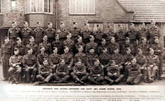
@Symptoms @The 14th battalion was made up of ”men in reserved occupations and those under or over age to serve in the armed forces”. Do you know if those men would be volunteers or conscripted?
-
Thank God for that!
-
 Good question!
 -
I'm still thinking this photo is in Vulcan Place, perhaps opposite the pub. If you look at old maps there was no building going on in Vulcan Place until sometime 1870 - 80. The rest of central Bedlington is a great deal older. It's reasonable to believe that stone-working skills had improved from the rough cuts seen in the earlier photos.
-
Sadie is the diminutive name of the name Sarah. James and Mary, both born 1895 in Bedlington, had a daughter Sarah Jane, born 1914. They had two other children: William George born 1918 and Phyllis born 1919. I think the child in the photo, if she is known as Sadie, is probably Sarah Jane. Could the photo have anything to do with the end of WW1? Early 1920s?
-
Thanks Eggy! I'll have a look at that.
-
There are a couple of names here that are very interesting to me in my research - Hedley and Heron. If anybody has any information about the 14th batt. Bedlington, I'd love to know more about them. What was their connection to BGS?
-
There aren't a lot of photos of Vulcan Place but clean cut bricks appear often in Bedlington's east end, especially noticeable in the buildings on the south side. Have a look in the gallery "Drinking establishments" for buildings around the Black Bull. We need some better photos.
-
I’m going to stick my neck out and say that it’s not a stone’s throw from the Barrington Arms in Vulcan Place. The clothing of James and Mary Morgan - no coats and James with his sleeves rolled up (possibly ready for, or even at, work) seems to suggest that they’ve just stepped outside for a minute, rather than be off on an outing. The woman in the front row is even wearing her slippers.
-
I knew i'd seen it somewhere! Now, if I could only find where i saved it on my PC!
-
You'll need to explain this one for me
-
Every coin has two sides so the situation you predict should more houses be built could equally well apply to the building of a leisure facility ie. logistical problems as people exit their homes en-masse to go to that facility for leisure purposes. I am, of course, assuming it would be the people of Bedlington who would be using it so the same people who are causing logistical problems by leaving their homes en-masse for work, school and shopping would be the same people leaving their homes en-masse in the evenings and at weekends to go to a leisure facility (I can’t really visualise anybody travelling from Ashington, Cramlington, Morpeth or Newbiggin when they have such a facility nearer home). The latter I see only as adding to the supposed logistical problems for Bedlington. I don’t believe the logistical problems related to going to work, school or to shop would change dramatically should more housing be built. Sometimes we just need to think outside the box. The recent Covid issue has shown that people now WANT to work from home and some companies have already closed their offices in favour of just that. Flexi-time has a long history and many professions, by their very nature, crave flexible working hours: health service, emergency services etc.. child care facilities, to name just a couple. There are also people who work far from home and travel only on a weekly, fortnightly or even monthly basis. Working 9 to 5 (thus clogging up the infrastructure) is a thing of the past – and not only for Dolly Parton. As for schools, they can also have staggered start and finish times. I’m not au fait with college times in Bedlington but here college students (over 16s) have 4-5 lessons a day and the remainder of the day is for own study, homework, groupwork etc.. If their first planned lesson is at 10 am they don’t need to be in school till 10am. If their last lesson finishes at 2pm then they can leave at 2pm – provided, of course, that they don’t want/need to use school facilities, such as libraries, computer rooms or sports facilities when they are welcome to stay. Going shopping doesn’t have to clog up the logistical works either. What happened to shopping on the way home from work and thereby saving petrol money and the environment? And, who’s to say that any of the above groups (workers, students, shoppers) would increase in size should there be new housing in Bedlington? Perhaps Bedlington is on its way to becoming a very pleasant dormitory town attractive to pensioners like myself or city workers looking for a ’no stress’ abode? Who knows what Bedlington will be like in 10 years time? We can’t predict the future. Lord knows I, who likes to know exactly how much money I have in my purse when i go shopping, (it’s an OAP thing!) could never have foreseen that a piece of plastic would herald the asphixiation of coins and bank notes. It ruffles my feathers enormously when shops refuse to accept cash. However, I do have a choice. If I want food I can go with the flow and accept that times have changed and cash is no longer an option OR I can go to another shop some miles away because I know that they still accept cash. It’s not unlike the problem facing Bedlingtonians regarding leisure centres. There are alternatives. If a leisure centre is important in one’s life , as food is important in mine, then it’s worth the effort of travelling locally or, in a worst case scenario, even moving house. I personally thought that I was spoiled for choice regarding leisure centres when living in Bedlington. Me and mine must have added enormously to the logistical problems of Bedlington, Cramlington, Blyth and Morpeth with our three visits a week.
-
Nedderton village must be first on your list! I'll be in touch to explain why soon.
-
Thanks, I'll see what I can do.
-
two memories are better than one - so one of us will.
-
Such a pity that you don't recognise any names, Allan! However, this family information is from 1911, some 9 years before your father's birth, so they could well be relatives. The 1921 census should be released soon and we can get a better picture of where your father lived. However, there are other sources available for research and if you'd like to give me your father's full name and date of birth I'd be happy to have a look for you. Of course, you don't need to post that information publicly. you can send me a direct message if it feels better.
-
A little correction needed there, Eggy. Plessey Street is not shown. The 1921 map only shows First-, Second- and Third street. Second Street being the two centre rows of the four with Third Street to the left and First Sreet to the right of them.
-
Allan, if you view the video above you will see Plessey Street, formerly called 2nd Second Street. It looks a bit the worse for wear in the video but in 1920, when your father was born there it would be almost "state of the art" as those rows were built between 1907 and 1915 and brought such "mod-cons" as outdoor, flushing toilets, electric lighting and a fresh water tap, in the street - one tap for every 8 houses! You'll find many more details on the photos in the gallery recommended above by Alan Edgar. If you've any questions feel free to ask.
.thumb.jpg.7493ddab4a696108cf2b849323d3c155.jpg)